Search This Blog

Showing posts with label heron. Show all posts

12 Jan 2023

thumbnail

PRESS RELEASE — GEXCEL HERON 3D Mobile Mapping: Improvements in Accuracy and Usability

 Gexcel HERON software improvements


Brescia, Italy, January 12th, 2023

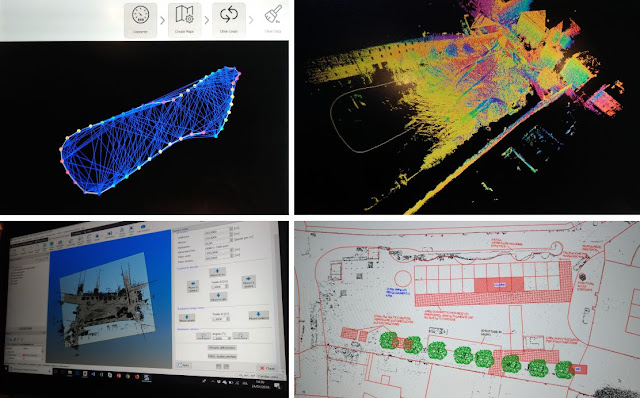
The recently released versions of HERON processing software(s) make HERON 3D mapping projects more accurate, effective and usable thanks to important improvements in the usage of ground control points, in the change detection workflow, and for the cloud-sharing process.
 

CONSTRAINT TOOL


Several ways to constrain and geo-reference HERON trajectories.
Ground Control Points (GCPs)
- Measuring GCPs directly in the field by using HERON and a calibrated pole or
- Identifying CGPs on the HERON point cloud.
GCPs local coordinates are automatically paired with the related global coordinates.
Point Clouds and Scans
Static scans or portions of 3D point clouds previously acquired also with different sensors (UAV, mobile scanners, mapping systems, photogrammetry) can be used as constraints as well.

Constraint procedures play a crucial role to improve the quality of the final trajectory!

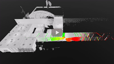
CHANGE DETECTION MAPS

HERON - Change Detection Map


1. Use a point cloud or BIM model as a reference map.
2. Let HERON self-locate with respect to the reference.
3. Produce a survey aligned with the reference map.
4. Detect changes that occurred in the time.
5. Automatically get the change detection map for further editing.

CLOUD SHARING

Mobile mapping is dramatically speeding up the process of capturing 3D and image data. This should be matched by the speed of project delivery and online procedures.


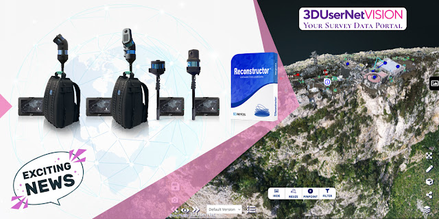
To increase Site to Sight of data efficiency, GEXCEL customers can now link up with 3DUserNet to get a special free annual subscription to the VISION platform with a direct workflow from Reconstructor to 3DUserNetVISION. This will enable users to deliver more efficiently for their customers – with the opportunity to upgrade to a full subscription at a substantial discount at any time.

For additional information: sales@gexcel.it


24 Nov 2021

thumbnail

PRESS RELEASE — GEXCEL and 3DUserNetVISION combine to offer speed and efficiency in mobile mapping

HERON & Reconstructor data sharing by 3DUserNetVISION

Brescia, Italy, November 24th, 2021

«We are glad to announce the collaboration with 3DUserNetVISION because this means we can provide our HERON and Reconstructor clients with 3D point clouds and image data sharing services for mapping projects». Giorgia Rossi, International Sales Manager of Gexcel

All data acquired with HERON and all 3D models managed with Reconstructor can now be directly uploaded to 3DUserNetVISION and shared in the cloud. And thanks to this partnership, all existing and new Gexcel customers can get the platform at a special rate.

Getting data quickly from scanner to user is more and more crucial in today's demanding world of survey, where several partners need to easily access 3D models to speed up decision-making processes. Heron and Reconstructor give you high-quality outputs quickly and accurately, VISION makes them worldwide and immediately accessible.

Uploading point clouds, meshes and images directly to 3DUserNetVISION from Reconstructor, gives immediate and secure access to project data for a team, for viewing and collaboration on deliverables. And it works on all your devices, so you have your data with you at all times.

Gexcel customers are able to obtain a 25% discount on their first full year subscription of any VISION modules and data packs. REQUIRE YOUR DISCOUNT >> CLICK HERE

27 May 2021

thumbnail

HERON SUCCESS CASE — VOLUMES OF SCRAP METAL STOCKPILES

THE PRODUCTION PROCESS OPTIMIZATION IN A STEEL PLANT 

Feralpi Group – Lonato, Brescia (IT)

PDF versione italiana

PROJECT DESCRIPTION

KEYWORDS: Steel plants | Volumes computation | Stockpiles | Heron | 3D Mapping


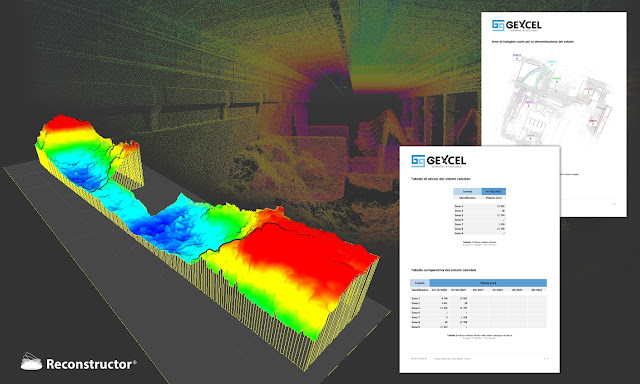
HERON portable mobile mapping - stockpile volume computation - Feralpi Group

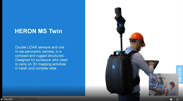
HERON MS TWIN-metal stockpile 3D mapping


Feralpi has set itself the goal of introducing advanced systems to monitor and verify the flows of raw materials and by-products of the steel mill, in order to optimize its production process.
Feralpi has chosen HERON technology because it fits their different needs. On one hand, the need to periodically obtain the volumes of the scrap stockpiles stored on a large area of the plant; on the other hand, the need for a high speed of scanning and results delivery, ensuring the required accuracy.
The project involves a monthly survey of the material stockpiles with HERON portable laser scanner technology.
During the 3D modelling phase, the stockpiles are isolated from the structural elements of the plant to define their volume.
The day after the measurement, a technical report with the measurements of the overall volumes is provided to Feralpi.
Thanks to this technological improvement, Feralpi is experimenting with a more efficient approach to the management of raw materials at low costs.


NEEDS AND GOALS
  • To monitor and verify the flows of raw materials and by-products of steelworks by using advanced systems.
  • To optimize the production process.


« Thanks to HERON technology we are able to map our material parks in a short time and with high precision. »


Gianpaolo Foglio |  
Head of Steelworks at Feralpi Siderurgica S.p.A.


HERON-Reconstructor scrap metal stockpile volume computation - Feralpi Group


HERON MAIN BENEFITS

  • Fast and simple mapping procedures easy to reproduce
  • Fast mapping of large stockpiles
  • No impact on daily production activities
  • Fast volumes computation
  • Centimetre level accuracy
  • Costs reduction
  • Production efficiency improvement
  • Usable for mapping different type of sites (steel plants as well as buildings)

              RESULTS

              • Stockpiles 3D modelling
              • Volumes computation

              TECHNICAL DETAILS

              • SURVEYING SYSTEM: HERON portable mapping system
              • SURVEYING TIME: about 1 h for 18.300 m2
              • PROCESSING SOFTWARE: HERON Desktop - Reconstructor
              • DATA PROCESSING TIME: half working day


              To carry out the work, Feralpi Group makes use of the HERON rental service with the operator, data processing and delivery of results.


              ABOUT

              The Feralpi Group is one of Europe's leading steel manufacturers. It offers innovative and sustainable answers to the steel supply chains thanks to a diversified and vertical business.

              12 Oct 2020

              thumbnail

              PRESS RELEASE — Gexcel presents HERON® MS Twin

              Brescia, Italy, October 7th, 2020_Gexcel is glad to present the new HERON® MS Twin: a double Lidar sensor portable mobile mapping system, equipped with a 5k RGB panoramic camera. Thanks to its advanced hardware+software technology, the users can benefit from a very high-level performance in terms of geometric robustness of 3D models.


              Key points of usability:

              • Compact capture head easily mountable on a backpack or various supports like cars, bikes, quads, etc.
              • Light rugged backpack usable both for transportation and surveying.
              • Automatic and on-demand RGB data acquisition.
              • Loop closure and initialization procedure not required.
              • Automatic self-localization on a reference model, when available.
              • Annotation collection during the walk.
              • Usable in every light conditions.
              • Hands-free surveying.
              • Real-time display of panorama images, 3D point cloud, and trajectory on the rugged Control Unit.

              Key points of data processing:

              • SLAM post-processing software (HERON® Desktop) included. The automatic advanced processing tools can be also personally set up by the user.
              • New trajectory quality assessment which improves the SLAM drift effects reduction (patented algorithm).
              • Innovative very dense point cloud rendering with multiple colour layers.

              HERON MS Twin color layer

              • Static scans usable as trajectory constraints (patented algorithm).
              • Innovative panorama tool to directly export images and 3D data in ReCap® (with Realview® display) and in E57 to easily go to OrbitGT, Edgewise®, FARO® Scene and Scene Webshare Cloud.
              • New “splat rendering” and “eye dome lighting" rendering effect. Features and details are emphasized and well visible.
              • GoBlueprint free tool to share the survey results with final clients or colleagues included.

              HERON GoBlueprint

              • Advanced 3D point cloud data analysis software included (Recontructor®).
              • Dedicated tools to navigate 3D models.
              • Real-time change detection.

              Thanks to these advanced features, HERON® MS Twin is the perfect system for surveyors who works indoors, outdoors, in underground mines, multi-level buildings, tunnels, cultural heritage sites, forensic procedures, forests, urban areas, harsh and complex areas.

              HERON® MS Twin can make the user able to obtain several outputs from collected data: volume computation, excavation progress monitoring, digital archive, construction progress monitoring, floor plans generation for asset management, logistic/traffic management, dilapidation monitoring, scan to BIM, contours and profiles, 3D virtual experience, real-time change detection, as-built generation, security and safety, and much more.

              * * *

              New HERON MS Twin Live Demo

              - watch the webinar recording -

              new HERON MS Twin - Webinar
              New HERON MS Twin Live demo - Recording
              6 Oct 2020

              thumbnail

              EVENT — The Gexcel program for INTERGEO DIGITAL 2020


              Gexcel is ready for the new DIGITAL INTERGEO adventure, and you?

              Don't miss the opportunities to better know the Gexcel's products during these days. Join one of our live webinars:

              new HERON MS Twin Live demo
              Discover the innovative and outstanding Gexcel portable mobile mapping system

              OPMMS Open Pit Mine Monitoring System
              The powerful system to monitor mines' sites automatically and remotely

              RECONSTRUCTOR Point Cloud processing software
              Laser scanner+Drone+Thermo camera: a restoration project in Peru

              5 Jul 2019

              thumbnail

              EVENT — HERON technology for Museum documentation and Tourism activities

              23th July 2019, Italy — Presentazione del lavoro di rilevamento dell'area espositiva Museo Ridola.


              HERON Ridola Museum documentation

              Si rinnovano i successi e la scelta della tecnologia HERON per lo sviluppo di attività Turistiche e Museali. Questa volta l'interesse arriva da parte del Ministero dei Beni e delle Attività Culturali (MIBAC) e dal polo Museale della Basilicata per progetti dedicati allo sviluppo del territorio. 

              Il 23 Luglio 2019 nella storica Sala conferenze del Museo Archologico Nazionale "D.Ridola" Gexcel presenterà il progetto di rilevamento 3D eseguito nel Luglio 2018, dell'intera area espositiva del museo Ridola mediante l'uso di HERON iMMS (Indoor mobile mapping system).

              La conferenza è aperta al pubblico ed aprirà le porte alla X International Summer School, organizzata dal Comitato Internazionale Fotogrammetria Architettonica - COIFA e dal Prof. Pietro Grimaldi.

              Per maggiori informazioni riguardo all'utilizzo di HERON o per partecipare alla conferenza: marketing@gexcel.it

              3 Jun 2019

              thumbnail

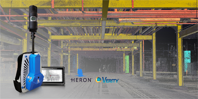
              PRESS RELEASE — HERON®-Verity Integration Introduces Real-Time 3D Mobile Mapping and Construction Verification


              HERON - Verity integration


              The collaboration between HERON, the latest wearable mobile scanners from Gexcel and Verity construction verification software from ClearEdge3D, significantly advances scan-to-BIM workflows with streamlined data collection and construction QA/QC

              Manassas, VA – May 29, 2019 – ClearEdge3D, makers of EdgeWise, Verity, and Rithm for Navisworks software, is pleased to announce a collaboration with Gexcel, makers of HERON® wearable scanners, that was unveiled at the SPAR 3D & AEC NEXT conferences last week in Anaheim, CA. 
              The two companies have joined forces to make it even quicker and easier for AEC professionals to conveniently gather as-built data with Gexcel’s HERON wearable laser scanners—and to compare that data against design/fabrication models using ClearEdge3D’s Verity software, allowing 100% verification of installed work in real-time.
              "The partnership between ClearEdge3D and Gexcel brings together two globally recognized AEC tech leaders in the 3D world that are committed to making scan-to-BIM workflows more efficient with truly cutting-edge technologies," - Matteo Sgrenzaroli, Gexcel R&D Manager 
              “It’s not just a commercial agreement, but a demonstration of our commitment to providing outstanding solutions to our customers and the AEC industry." - Giorgio Vassena, Gexcel CEO
              “The HERON scanner is a state-of-the-art 3D mobile scanner powered with cutting edge Simultaneous, Localization And Mapping (SLAM) technology. It features a host of proprietary algorithms to minimize drift and maximize accuracy and speed. We are excited to add it to our growing hardware portfolio.” - Kelly Cone, VP of AEC Industry Strategy at ClearEdge3D. 
              This forward-thinking partnership makes it even easier and more convenient for users to find construction mistakes before they become expensive problems. Using real-time visualization of survey results, users can promptly identify out-of-tolerance or inaccurately constructed work. For companies interested in learning more about this collaboration, please contact us at: sales@gexcel.it for more information. 


              About ClearEdge3D 
              ClearEdge3D is a global technology leader in the Architectural/Engineering/Construction (AEC) industry, offering advanced software solutions that help firms model existing conditions and verify that recently completed work has been constructed correctly. The company’s EdgeWise software dramatically speeds labor-intensive 3D modeling workflows by utilizing advanced automated feature extraction and assistive modeling technology. Its Verity construction verification software compares point cloud data of recently completed work against a design or fabrication model, flagging any out-of-tolerance or poorly installed elements. For more information, please visit http://www.clearedge3d.com. 

              About Gexcel 
              Gexcel started in 2007 with the mission to turn the latest scientific achievements in the field of geomatics into hi-tech products and services for wide areas of application. Gexcel is a worldwide well-known company capable to transform its know-how in advanced 3D surveying technologies, innovative and productive software and instruments. Gexcel has a rich history spanning more than 10 years of proven fully featured LiDAR and imagery analysis software compatible with all the lidar sensors of the main laser scanner manufacturers. Gexcel is currently present on the market with innovative surveying instruments and it is involved, with several partners, in various projects for the development of innovative solutions based on laser scanner, SLAM and digital photogrammetry.   

              11 Dec 2018

              thumbnail

              PRESS RELEASE — Gexcel presents the new HERON® Indoor Mobile Mapping System

              11th December 2018, Italy — Thanks to the new full HD 360° panoramic camera, HERON® has become a powerful tool for geospatial data mining: to digitally document, collect and geo-reference large dataset and information inside indoor environments has never been so easy, thanks to the perfect integration with OrbitGT packages too.

              Gexcel - New HERON Indoor Mobile Mapping System


              Gexcel is glad to introduce the market to the innovative benefits provided by the new HERON® family:
              • Thanks to the new high-res 360° panoramic camera, HERON® has become the best choice for facility management, geospatial applications, digital 3D documentation, digital twins for remote planning and project, revamping projects of industrial plants, etc.
              • With the GoBlueprint® free tool (fast point clouds 2D visualization), HERON® users can easily share with clients, already in the field and almost in real-time, the results of the HERON® fast 3D mapping.
              • Now, point clouds coming from drones and/or static scans, as GNSS known points, can become constraints information inside the workflow of the HERON® 3D SLAM data processing.

              Gexcel - GoBlueprint free tool


              The HERON® family is currently composed of HERON® AC-2 and HERON® MS-2 (rugged device for underground mines or difficult environments), both available in the Color configuration. The HERON® LITE model is the best solution for customers who want to join the HERON® family with an affordable investment.


              6 Dec 2018

              thumbnail

              HERON SUCCESS CASE — CIVIL PROTECTION

              PLANNING THE SECURITY OF PUBLIC EVENTS Fair square, Trento (IT)

              PDF versione italiana

              PROJECT DESCRIPTION

              KEYWORDS: Civil protection | Security | Public event management | Heron | 3D Mapping 

              One of the main problems in planning a public event is the lack of updated data. Over time, a site is subject to multiple changes (sidewalks, green areas, maintenance or remediation, etc.) and not always the maps, available for civil protection, represent real metric data. All these issues were met in the present use case, where a tensile structure was planned in the main square of Trento.


              NEEDS AND GOALS
              • Check for any differences between the existing cadastral maps and the current state of the square, in order to detect the presence of new elements potentially obstructing the public security plans.
              • Provide easy and effective analysis of places dedicated to events/fairs, starting from real and updated data.

              « I’ve been amazed of the speediness of HERON in providing us with real data of the location we chose for the event! Without the HERON real data we would not have seen that this space was not suitable for the structures and the pool of people we had in mind. »

              Stefano Farina | Safety Consultant and Trainer


              Trento square data elaboration

              Thanks to a quick walk with HERON it was possible to generate an updated map of the square and proceed with the planning of the safety of the routes. It was possible to discover that the large trees (not marked in the old maps) were a serious obstacle to the management of the event. It was therefore decided to change locations, preventing a huge waste of money and work. (Read more about the Italian public event rules "DECRETO GABRIELLI")


                Public event planning


                HERON AC-1 MAIN BENEFITS
                • Rapid survey and analysis of (large) environments both external and internal.
                • Real-time generation of 3D and 2D maps with 2-3 cm accuracy. 
                • Quick and frequent update of 2D and 3D maps thanks to the automatic localization of the instrument. Survey easily managed by operators with minimal knowledge of surveying.

                RESULTS
                • Blueprint map of the square
                • CAD map with safety path scheme
                • 3D point cloud model of the square

                TECHNICAL DETAILS
                • SURVEYING SYSTEM: HERON AC-1 Color
                • SURVEYING TIME: 720 mt in 9 minutes by walking
                • PROCESSING SOFTWARE: HERON Desktop - JRC 3D Reconstructor
                • DATA PROCESSING TIME: 45 minutes


                ABOUT

                The Client required to Gexcel the rent of HERON with the operator for the surveying activities and the data processing delivery. For a privacy agreement, Gexcel is not allowed to show the Client’s name.

                9 Nov 2018

                thumbnail

                HERON SUCCESS CASE — MUSEUM DOCUMENTATION

                VIRTUAL REALITY FOR MUSEUM SERVICES ORGANIZING
                MarteS - Art museum Sorlini, Calvagese della Riviera (IT)

                PDF versione italiana

                PROJECT DESCRIPTION

                KEYWORDS: Virtual reality | Art | Museum | Heritage | Digitalization | HERON


                The "Luciano Sorlini Foundation" is located within the largest architectural complex of Calvagese della Riviera and, from March 31, 2018, is the headquarters of the MarteS. Sorlini Museum of Art: a private art gallery that exhibits to the public the works collected over time by the entrepreneur from Brescia Luciano Sorlini (1925-2015). Before the opening to the public, Stefano Lusardi, conservator of the new museum, and Giustina Irene, from DICATAM University of Brescia, commissioned a 3D survey of the building for museum services organizing.


                For this particular work, the Topotek company has chosen to exploit the HERON AC-1 Color technology. 3D mapping acquisitions were carried out following two paths: the first one walking along 1.390 meters in 22 minutes crossing the gardens and the open spaces inside the court, and the second one of 610 meters, extended from the gardens to the outside of the villa, by covering the whole block, including the city square and the war memorial monument. Using the HERON Desktop software, it was possible to obtain a point cloud in .ply format and an "x-ray plan". After that, the results were imported into JRC 3D Reconstructor and automatically aligned.


                In an hour only, the 3D movie of the detected building was generated. Thanks to the HERON technology, was quickly acquired a large number of elements, fundamental for future museum projects. We are therefore faced with the possibility of moving 3D data into video animations or exploiting them to create interactive activities for VR viewers.


                NEEDS AND GOALS
                • A fast survey of the ancient Sorlini palace to generate a 2D drawing of the main building surrounding
                • Realized a 3D movie for the MarteS museum inauguration
                • Using the acquired 3D data to the future plan of museum services organization

                HERON AC-1 MAIN BENEFITS
                • Innovation of the product
                • Speed in obtaining technical drawings
                • Intelligibility with third-party 2D and 3D resources

                RESULTS
                • 2D blueprint plans
                • Indoor and outdoor 3D flythrough video
                • 3D point cloud with trajectory and photographic information

                TECHNICAL DETAILS
                • SURVEYING SYSTEM: HERON AC-1 Color
                • SURVEYING AREA: 2.000 sqm
                • SURVEYING TIME: 29 minutes by walking
                • PROCESSING SOFTWARE: HERON Desktop and JRC 3D Reconstructor
                • DATA PROCESSING TIME: 45 minutes + 1 hour for the movie creation

                16 Oct 2018

                thumbnail

                HERON SUCCESS CASE — 3D MAPPING OF UNDERGROUND MINES

                3D SURVEYING OF UNDERGROUND FIELDS FOR GEOLOGICAL ANALYSIS Abandoned mines of Paglio (Dossena, BG), Italy

                PDF versione italiana

                PROJECT DESCRIPTION

                KEYWORDS: Mining | Underground | HERON | 3D Mapping


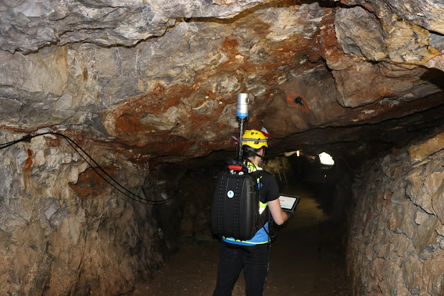
                HERON®MS-1 inside the Dossena underground site

                Dossena's mine survey activities

                NEEDS AND GOALS
                • Geometric acquisition of underground environments at various levels of depth in a disused mine.
                • Production of georeferenced data for subsequent assessments of geological stability of the site.

                Underground mines represent an important challenge for geometric surveying activities. The narrow spaces, sudden gradients, the presence of water, dust and humidity, the uneven paving and the impossibility to receive the GNSS signal often make it impossible to apply the traditional survey techniques. At Paglio's abandoned mines, thanks to the use of HERON system, it was possible to penetrate the entrails of the mines and measure the extent of underground environments, providing a mesh model of the entire structure.

                « The rugged backpack of HERON MS-1 made it possible to easily move around the different environments, even where the presence of water and dust could have hindered the success of the work »

                Stefano Cantoni | Surveyor, University of Brescia

                HERON Dossena mining analysis
                HERON point cloud aligned with a georeferenced static scan

                RESULTS

                • 3D point cloud model
                • 2D map (blueprint)
                • Surfaces model (mesh) of surveyed environments
                • Profiles and sections
                • Volumes and areas

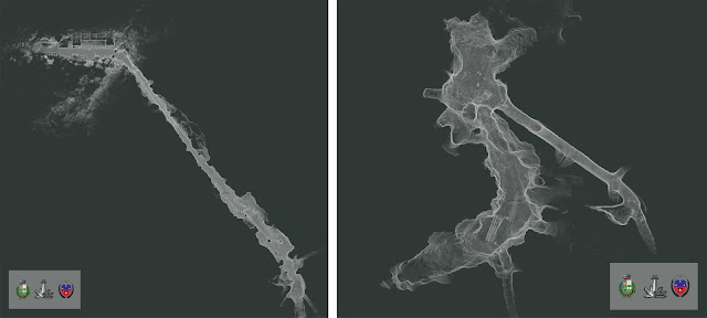
                The carried out activities are part of the studies and works aimed at the recovery of the former fluorite mines of Paglio Pignolino in the Municipality of Dossena (BG) for fruition, tourism and scientific purposes. The described case saw the use of the HERON system in its rugged version called MS (Mining Survey), designed to operate effectively in aggressive environments such as deep mines. The data processing has produced 3 plants of the mine almost in real-time, thanks to the HERON Desktop software. The 3D point cloud generated by the instrument was subsequently transformed into a mesh model with the JRC 3D Reconstructor software.


                Dossena mine planimetric view
                Planimetric view of different deep mining levels

                The interventions are commissioned and coordinated by the Municipal Administration, with the support of the Dossena Mining Association, for the management of the site, and of the geological associated study of Spada di Ranica for the study and design activities, with the collaboration of the University of Brescia.


                HERON MS-1 MAIN BENEFITS
                • Quick mapping of internal environments, without the use of targets for merging 3D scans.
                • Rapid detection (acquisition time equals walking speed).
                • Sturdy equipment suitable for aggressive environments.
                • Possibility to georeference the surveyed model.
                • Real-time control of the surveying process through 3D visualization of the acquired data.

                TECHNICAL DETAILS
                • SURVEYING SYSTEM: HERON MS-1
                • SURVEYING TIME: 2 hours for a path of 1,255 m and for georeferencing activities (through detection of spheres previously georeferenced with the total station)
                • PROCESSING SOFTWARE: HERON Desktop and JRC 3D Reconstructor®
                • PROCESSING TIME: 8 hours

                13 Sept 2018

                thumbnail

                HERON SUCCESS CASE — STREET EVALUATION AND UNDERGROUND DETECTION


                MAPPING AND ANALYSIS OF UNDERGROUND TUNNEL AND UPPER STREETS Aposa underground river, Bologna (Italy)

                PDF versione italiana

                PROJECT DESCRIPTION

                KEYWORDS:  Street evaluation | Urban analysis | Mapping | HERON | Wearable 3D Laser Scanner | Underground city verification


                Gexcel, in collaboration with Topcon Italy, College of Surveyors di Bologna and Amici Delle Acque Association, carried out the 3D survey of the underground river Aposa. The ancient tunnels have been mapped and analyzed to verify the level of structural deterioration, dangerous for overlying squares and roads, and to plan possible conservation activities.


                HERON outdoor survey of the Aposa river
                Fig.1_HERON outdoor survey of the Aposa underground river
                Bologna underground tunnel entry
                Fig.2_The exit from the city underground tunnel


                NEEDS AND GOALS

                • Generate a 3D model of the underground city tunnels
                • Update the existing city map with 3D laser scanner information
                • Obtain a geo-referenced 3D survey
                • Analyze the geometry to prevent collapses or faults and historical monuments deterioration


                HERON survey of the Bologna underground tunnel
                Fig.3_The Aposa underground tunnels and the HERON surveying 


                HERON AC-1 technology has been used to detect approximately one kilometre of route distributed between streets, squares and underground tunnels, without the need for GPS systems. The duration of the survey corresponded to the time taken by the operator to walk. Some spherical targets were placed along the tunnel, noting down their coordinates directly on the HERON Control Unit. In this way, geo-localization could also be achieved. The many cavities along the tunnel were not a problem and the operator was able to survey even the narrowest of them.  (See Video)


                Bologna underground topographic surveying
                Fig.4_Topographic surveying of a portion of the Aposa tunnels


                The topographic survey was carried out, using 8 control stations and 40 reference points for a high geometric accuracy result. The Topcon GLS2000 static laser scanner survey was necessary for a very old and particularly damaged part of the tunnel. In this way, high-resolution data was obtained, useful for an accurate analysis of the actual state of the structure.


                Bologna 3D underground analysis
                Fig.5_Bologna underground tunnel and upper street analysis 

                Aposa underground tunnel cross section
                Fig.6_The Aposa Underground tunnel cross-section


                Combining the HERON global survey with high-resolution scans, it was possible to document a significant urban area, obtaining multilevel information and a complete 2D and 3D mapping.
                Here some of the HERON technology benefits:

                • Fast mapping of a large area in difficult surveying conditions
                • Fast and frequent update of site’s 3D models' thanks to the automatic geo-localization feature. Operators with basic knowledge in surveying and geo-localization can easily manage it. 
                • Easy integration with coloured point clouds from terrestrial laser scanners


                RESULTS

                • Detailed technical table
                • Plans, sections, elevations, high-resolution orthophotos and photo plans
                • 3D point cloud model
                • 3D model flythrough movies
                • Topcon terrestrial laser scanner and HERON mobile mapping system joint 3D model


                Aposa: Bologna underground 3D model
                Fig.7_The joint 3D model visualized in the JRC 3D Reconstructor software