Search This Blog

Showing posts with label events. Show all posts

6 Oct 2020

thumbnail

EVENT — The Gexcel program for INTERGEO DIGITAL 2020


Gexcel is ready for the new DIGITAL INTERGEO adventure, and you?

Don't miss the opportunities to better know the Gexcel's products during these days. Join one of our live webinars:

new HERON MS Twin Live demo
Discover the innovative and outstanding Gexcel portable mobile mapping system

OPMMS Open Pit Mine Monitoring System
The powerful system to monitor mines' sites automatically and remotely

RECONSTRUCTOR Point Cloud processing software
Laser scanner+Drone+Thermo camera: a restoration project in Peru

5 Jul 2019

thumbnail

EVENT — HERON technology for Museum documentation and Tourism activities

23th July 2019, Italy — Presentazione del lavoro di rilevamento dell'area espositiva Museo Ridola.


HERON Ridola Museum documentation

Si rinnovano i successi e la scelta della tecnologia HERON per lo sviluppo di attività Turistiche e Museali. Questa volta l'interesse arriva da parte del Ministero dei Beni e delle Attività Culturali (MIBAC) e dal polo Museale della Basilicata per progetti dedicati allo sviluppo del territorio. 

Il 23 Luglio 2019 nella storica Sala conferenze del Museo Archologico Nazionale "D.Ridola" Gexcel presenterà il progetto di rilevamento 3D eseguito nel Luglio 2018, dell'intera area espositiva del museo Ridola mediante l'uso di HERON iMMS (Indoor mobile mapping system).

La conferenza è aperta al pubblico ed aprirà le porte alla X International Summer School, organizzata dal Comitato Internazionale Fotogrammetria Architettonica - COIFA e dal Prof. Pietro Grimaldi.

Per maggiori informazioni riguardo all'utilizzo di HERON o per partecipare alla conferenza: marketing@gexcel.it

6 Dec 2018

thumbnail

HERON SUCCESS CASE — CIVIL PROTECTION

PLANNING THE SECURITY OF PUBLIC EVENTS Fair square, Trento (IT)

PDF versione italiana

PROJECT DESCRIPTION

KEYWORDS: Civil protection | Security | Public event management | Heron | 3D Mapping 

One of the main problems in planning a public event is the lack of updated data. Over time, a site is subject to multiple changes (sidewalks, green areas, maintenance or remediation, etc.) and not always the maps, available for civil protection, represent real metric data. All these issues were met in the present use case, where a tensile structure was planned in the main square of Trento.


NEEDS AND GOALS
  • Check for any differences between the existing cadastral maps and the current state of the square, in order to detect the presence of new elements potentially obstructing the public security plans.
  • Provide easy and effective analysis of places dedicated to events/fairs, starting from real and updated data.

« I’ve been amazed of the speediness of HERON in providing us with real data of the location we chose for the event! Without the HERON real data we would not have seen that this space was not suitable for the structures and the pool of people we had in mind. »

Stefano Farina | Safety Consultant and Trainer


Trento square data elaboration

Thanks to a quick walk with HERON it was possible to generate an updated map of the square and proceed with the planning of the safety of the routes. It was possible to discover that the large trees (not marked in the old maps) were a serious obstacle to the management of the event. It was therefore decided to change locations, preventing a huge waste of money and work. (Read more about the Italian public event rules "DECRETO GABRIELLI")


    Public event planning


    HERON AC-1 MAIN BENEFITS
    • Rapid survey and analysis of (large) environments both external and internal.
    • Real-time generation of 3D and 2D maps with 2-3 cm accuracy. 
    • Quick and frequent update of 2D and 3D maps thanks to the automatic localization of the instrument. Survey easily managed by operators with minimal knowledge of surveying.

    RESULTS
    • Blueprint map of the square
    • CAD map with safety path scheme
    • 3D point cloud model of the square

    TECHNICAL DETAILS
    • SURVEYING SYSTEM: HERON AC-1 Color
    • SURVEYING TIME: 720 mt in 9 minutes by walking
    • PROCESSING SOFTWARE: HERON Desktop - JRC 3D Reconstructor
    • DATA PROCESSING TIME: 45 minutes


    ABOUT

    The Client required to Gexcel the rent of HERON with the operator for the surveying activities and the data processing delivery. For a privacy agreement, Gexcel is not allowed to show the Client’s name.

    17 May 2018

    thumbnail

    EVENT — Gexcel and HERON at GEO Business Show 2018

    HERON® AC-1, the innovative Wearable Mobile Mapping System from Gexcel, is having a significant success worldwide on innovative BIM-check projects. Several customers are using the HERON® change detection feature to highlight differences between the reality and the BIM model: everything in real time.

    Real-time and effective scan to BIM quality check services on huge sites, such as airports, industrial plants, and construction yards are now possible!


    HERON® can survey complex environments without any external positioning system and is capable to highlight in real-time possible geometrical changes between different surveying sessions. Moreover, HERON® works as a localization system using either a former survey or a CAD model as reference frame.

    Thanks to these unique features, HERON® has been adopted by international institutions and large companies involved in the nuclear power plant and advanced industrial projects.


    >> Visit Us on Stand L15 at GEO Business (22-23 May, London) <<


    27 Mar 2018

    thumbnail

    EVENT — Gexcel and CSMT at the First China Global Experts Summit (CGES)

    20th March 2018, China — The first China (Ningbo) Global Experts Summit (CGES).


    CGES 2018


    The Global Experts Summit is a worldwide meeting focused on the world's cutting-edge technology and China's industrial demands, creating a platform where global talents and technologies seek cooperation and achieve win-win results.

    The CSMT of Brescia (Italy) attended the summit as a successful example of Italian technology transfer center and Gexcel was invited as one of the representative expert companies located at the CSMT technology center.


    During the event, Mr. Matteo Sgrenzaroli (R&D Project Manager at Gexcel) focused his presentation by showing the benefits of LiDAR technology, the new engineering solutions, and the market outer reach.


    A total of 239 high-tech projects from a variety of industries (aerospace, integrated circuits, new materials, etc.) sought cooperation and financial support through roadshows and matchmaking events at the summit.

    Find more about the event


    2 May 2017

    thumbnail

    EVENT — GEXCEL HERON is landing to GEO BUSINESS 2017


    May, 2017, Brescia (Italy) — Are you coming to GEO BUSINESS SHOW in London and are you curious to see the new Gexcel HERON® system at work? Join the Gexcel's community!

    Come to the Gexcel's Booth K14 and look at the HERON® mobile surveying system with its powerful and unique algorithm that makes the real time acquisition and the 3D model creation extremely smart and efficient!


    ...and don't miss the dedicated workshop!

    WORKSHOP TUESDAY 23rd 16.15
    Giorgia Rossi,Gexcel
    HERON® THE WEARABLE MOBILE SURVEYING SYSTEM
    Indoor or outdoor applications, walking or driving configuration able to provide 3D real time mapping, real time localization, change detection analysis and a powerful software brain to adjust and optimize scans. Access the Geo Business Agenda


    For more information and appointments
    please contact:

    Giorgia Rossi arch.

    International Sales Manager | Gexcel Srl
    E. sales@gexcel.it
    P. +39 030 65 95 001


    Subscribe the Gexcel's newsletter and follow us on our channels:

    [ youtube ]  [ twitter ]  [ facebook ]  [ linkedin ]


    About Gexcel
    Gexcel Srl has a rich history spanning more than 10 years of proven fully featured lidar and imagery analysis software packages as JRC 3D Reconstructor®, PointR3 and PixR3. Well-suited to all terrestrial, mobile and airborne scanners, Gexcel solutions are compatible and provided from all the main laser scanner manufacturers as DotProduct, Faro, Teledyne-Optech, Riegl, Stonex, Topcon, Trimble, Velodyne and Z+F. Gexcel Srl was established in 2007 from the academic know-how of the University of Brescia and the applied research achievements of the European Commission Joint Research Centre (JRC), located in Ispra (Italy).

    13 Apr 2017

    thumbnail

    EVENT — HERON and Focus3D integration at the FARO 3D Conference 2017

    April, 2017, Brescia (Italy) — Are you a FARO user and are you interested in learning more about the smart integration between your Focus3D scans and Gexcel HERON® 3D models?


    Come to the FARO 3D Conference on April, 27th-28th (Germany): Gexcel will present this great innovation by showing a dedicated presentation focused on a real case where this technology has been used to speed up the surveying activities and furnish a complete final project. 

    >> Register now <<  Come to the Conference and discover all the latest state of the art in reality capture, to exchange in technical meetings through real user examples and to discuss with experts.

    Don't miss the Gexcel Presentation, on Thu, 27th at 9.45 amto see how easily HERON® can make your Focus3D laser scanner surveys more competitive and efficient in a very simple way! Access the complete Conference Agenda.


    For more information and appointments
    please contact:

    Giorgia Rossi arch.
    International Sales Manager | Gexcel Srl
    E. sales@gexcel.it
    P. +39 030 65 95 001


    Subscribe the Gexcel's newsletter and follow us on our channels:
    [ youtube ]  [ twitter ]  [ facebook ]  [ linkedin ]


    About Gexcel
    Gexcel Srl has a rich history spanning more than 10 years of proven fully featured lidar and imagery analysis software packages as JRC 3D Reconstructor®, PointR3 and PixR3. Well-suited to all terrestrial, mobile and airborne scanners, Gexcel solutions are compatible and provided from all the main laser scanner manufacturers as DotProduct, Faro, Teledyne-Optech, Riegl, Stonex, Topcon, Trimble and Z+F. Gexcel Srl was established in 2007 from the academic know-how of the University of Brescia and the applied research achievements of the European Commission Joint Research Centre (JRC), located in Ispra (Italy).

    26 Oct 2016

    thumbnail

    PRESS RELEASE — HERON® The new real time mapping and tracking wearable system

    October 26th, 2017, Brescia (Italy) — Great success at INTERGEO (Hamburg, Germany) for HERON®: the innovative indoor/outdoor real time mobile mapping and tracking wearable system, (composed by hardware and software), developed by Gexcel and European Commission Joint Research Centre.


    HERON® is capable to support real time 3D measurements both in industrial plants and underground mining applications. HERON® does not use GNSS or precise IMU sensors, but just a clever and advanced algorithm.

    Real time mapping, automatic localization, real time change detection system. This absolute innovative approach to manage the real time mapping and tracking indoor projects is opening new possibilities for industrial/nuclear plants surveying and tracking, underground mining, forest mapping.

    Follow Gexcel on www.gexcel.it/en/heron-overview to find more on HERON® and its successfully applications.


    About Gexcel
    Gexcel Srl has a rich history spanning more than 10 years of proven fully featured lidar and imagery analysis software packages as JRC 3D Reconstructor®, PointR3 and PixR3. Well-suited to all terrestrial, mobile and airborne scanners, Gexcel solutions are compatible and provided from all the main laser scanner manufacturers as DotProduct, Faro, Teledyne-Optech, Riegl, Stonex, Topcon, Trimble and Z+F. Gexcel Srl was established in 2007 from the academic know-how of the University of Brescia and the applied research achievements of the European Commission Joint Research Centre (JRC), located in Ispra (Italy).

    For more information please contact:
    Giorgia Rossi arch. 
    International Sales Manager | Gexcel Srl
    Phone: +39 030 65 95 001

    --------------

    Published on:

    - http://www.geoconnexion.com/news/heron-the-new-real-time-mapping-and-tracking-wearable-system


    6 Jul 2016

    thumbnail

    PRESS RELEASE — Gexcel at the FARO 3D USER CONFERENCE ASIA PACIFIC 2016

    July 6th, 2016, Beijing (China) — On Friday 8th, during the FARO 3D User Conference (PRD JW Marriott Hotel Beijing),  Gexcel will present to the Asian market the innovative and outstanding software solutions to automatic align, organize and combine in a same project the FARO Focus3D static scans and the FARO Freestyle3D high resolution scans.
    Learn more http://gexcel.it/en/faro-freestyle


    Thanks to the collaboration with Guangzhou Scan Technology Ltd., the laser scanning 3D documentation surveying activities at the Foshan Chin Woo Assembly Hall (Chungshan Park, Foshan, China) will be presented. JRC 3D Reconstructor® has been successfully used for this important survey finalized to a restoration project. This example is a clear demonstration that using a powerful software like JRC 3D Reconstructor®, the data processing and the output extraction workflows give you excellent results in an easy and fast way.

    Mr. Yangting, from Guangzhou Scan Technology Ltd., said:

    «In 2016, Guangzhou Scan Technology Ltd. was commissioned by Chin Woo Athletic Association to conduct a survey of the assembly hall for restoration purpose. With the help of Faro Focus3D X130 scanner and Gexcel JRC 3D Reconstructor® software, a series of high-resolution point cloud images were generated and an accurate set of survey drawings were delivered later on as reference for restoration design in the coming future».


    «Foshan Chin Woo Assembly Hall, located in Chungshan Park, Foshan, was the largest and most well preserved Chin Woo hall in China. Built in 1935 (24th year of the Republic), the exterior of the building had the elements of ancient Chinese architecture: a double-eaves hip-and-gable roof with green glazed roofing tiles. While looked from the outside, it was a traditional seven-bay-wide corridor building, a modern steel truss design was adopted to create a long-span, column-free space inside the stadium. In 1998, Chin Woo Assembly Hall has been officially approved by Foshan government as one of the municipal culture relics. It has been forced shut down in 2010, however, due to poor condition resulting from lack of proper maintenance».


    == == == == == ==


    Find here the original Chinese text

    佛山精武体育会馆,是目前中国境内保存最好、规模最大的精武会馆。位于佛山禅城区中山公园内,建于1935年(中华民国二十四年)。该建筑外观为中国传统建筑形式,采用重檐歇山屋顶,上覆绿色琉璃瓦;下七开间柱廊,内部使用现代的钢结构桁架营造大跨度空间,是中国二十世纪初折衷主义现代建筑的代表作。1998年被佛山市政府认定为佛山市级别的文物保护单位。20104月,由于精武会馆建筑年久失修,精武体育会宣布闭馆。2016年思勘测绘技术有限公司受精武体育会委托,对该建筑进行三维激光测量。该项目使用Faro X130作为现场数据采集工具,并使用JRC 3D Reconstructor 进行三维点云的处理工作,获得的点云切片用于现状测绘图的绘制参考。最终的成果为达到修缮精度要求的测绘图。


    About Gexcel
    Gexcel Srl has a rich history spanning more than 10 years of proven fully featured lidar and imagery analysis software packages with the JRC 3D Reconstructor®, completely compatible with all terrestrial, mobile and airborne scanners from manufacturers such as Faro, Teledyne-Optech, Riegl, Stonex, Topcon, Trimble and Z+F. Gexcel Srl was established in 2007 from the academic know-how of the University of Brescia and the applied research achievements of the European Joint Research Centre (JRC), located in Ispra (Italy). Gexcel Srl is proud to support all major standard formats such as the ASTM E57 and LAS.

    For more information please contact:
    arch. Giorgia Rossi
    International Sales Manager | Gexcel Srl
    Phone: +39 030 65 95 001

    --------------


    Published on:


    1 Jun 2016

    thumbnail

    PRESS RELEASE — Gexcel at SPAR Japan 2016

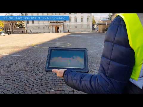
    June 1st, 2016, Tokyo (Japan) — On Wednesday 1st, prof. Yoshiki Hori, Professor of History of Architecture and City Planning in Europe, from the Department of Architecture and Urban Design of Faculty of Human-Environment Studies of the Kyushu University (Japan), will present at SPAR Japan 2016 his research activities in 3D laser scanning surveying of international archeological sites.

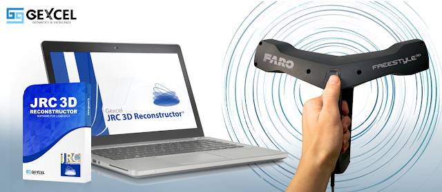
    At the same conference Mr. Muramatsu Kiyoshishin, Gexcel Japan technical manager, will chair a workshop focused on the use of the main Gexcel software for laser scanning, JRC 3D Reconstructor®.


    The workshop will also introduce
    - the new BIM&Industrial Plant Suite® (www.gexcel.it/en/software/suite)
    - the new compatibility between DotProduct® data and JRC 3D Reconstructor® (www.gexcel.it/en/dot-product)


    «JRC 3D Reconstructor® has been specifically designed to align or register many datasets and large volumes of point cloud data automatically. I can say that the point clouds processing engine of JRC 3D Reconstructor® can be used to improve the performance of the whole laser scanning data processing, providing a familiar software environment and meeting the needs of laser scanning data elaboration»

    These are the considerations about JRC 3D Reconstructor® given to Gexcel Japan by Prof. Yoshiki Hori who has a long experience on the use of laser scanning for the documentation of ancient archeological sites around the world and, in particular, in Roman Archeological sites as Pompei and Ostia Antica in Italy.


    Prof. Hori underlines that
    «Many dense and extensive datasets of point clouds, resulting in many gigabyte of data, usually require large amount of RAM and a high performance graphics cards, but the crucial stage remain the process known as cloud alignment or registration, which is done using targets, such as spheres or checker boards. As that process is inevitable in terrestrial laser scanning, we have to spend much time and effort to align or register datasets increasing their size during the post-survey process».
    Thanks to JRC 3D Reconstructor® now the data processing is faster than ever, in fact
    «In my laboratory a few under or graduate students used to captured more than 30 datasets per day and the pre-registration process could not be completed until the next morning. Actually they do not work more so hard with the software but just running the pre-registration command. JRC 3D Reconstructor® has become essential for the process of integration and management of many point clouds in different formats produced by Leica, Faro, Teledyne-Optech, etc.»


    ==========

    At SPAR Japan, Gexcel will also announce that, starting from 2016, has become the official representative of the SITECO RoadScanner  MOBILE MAPPING SYSTEM  in Asia Pacific. Configurable with various sensors and Inertial Navigation Systems, RoadScanner4 and RoadScanner Compact represent the right flexible choice for 3D mobile laser scanner surveying.

    Find more information about the system solutions


    About Gexcel
    Gexcel Srl has a rich history spanning more than 10 years of proven fully featured lidar and imagery analysis software packages with the JRC 3D Reconstructor®, completely compatible with all terrestrial, mobile and airborne scanners from manufacturers such as Faro, Teledyne-Optech, Riegl, Stonex, Topcon, Trimble and Z+F. Gexcel Srl was established in 2007 from the academic know-how of the University of Brescia and the applied research achievements of the European Joint Research Centre (JRC), located in Ispra (Italy). Gexcel Srl is proud to support all major standard formats such as the ASTM E57 and LAS.

    For more information please contact:arch. Giorgia Rossi
    International Sales Manager | Gexcel Srl
    Phone: +39 030 65 95 001

    --------------


    30 May 2016

    thumbnail

    PRESS RELEASE — Gexcel at the 3D Faro User Conference Asia Pacific 2016

    May 30th, 2016, Tokyo (Japan)


    How to efficiently merge Faro Freestyle3D and Focus3D colored point clouds?
    At the 3D Faro User Conference Asia Pacific in Tokyo, Japan (May 31st, 2016 - TKP Garden City Shinagawa) Gexcel will explain how JRC 3D Reconstructor® easily combines colored scans from hand and tripod lasers. This new feature allows to better use and combine multi-resolution and multi-sensor 3D data in a single project.


    On Tuesday 31st at 2.30 pm, Mr. Muramatsu Kiyoshishin from Gexcel Japan will manage the workshop focused on the JRC 3D Reconstructor® automatic 3D data alignment in the absence of targets.
    Gexcel will also present its new commercial and technical agreement with Siteco, realized to support the spread of the RoadScanner® Mobile Mapping System in the Japanese and Asian markets.


    About Gexcel
    Gexcel Srl has a rich history spanning more than 10 years of proven fully featured lidar and imagery analysis software packages with the JRC 3D Reconstructor®, completely compatible with all terrestrial, mobile and airborne scanners from manufacturers such as Faro, Teledyne-Optech, Riegl, Stonex, Topcon, Trimble and Z+F. Gexcel Srl was established in 2007 from the academic know-how of the University of Brescia and the applied research achievements of the European Joint Research Centre (JRC), located in Ispra (Italy). Gexcel Srl is proud to support all major standard formats such as the ASTM E57 and LAS.

    For more information please contact:
    arch. Giorgia Rossi
    International Sales Manager | Gexcel Srl

    7 Mar 2016

    thumbnail

    PRESS RELEASE — New JRC 3D Reconstructor® 3.2.1 and LineUp® Pro automatic target-less registration tool now available also for Topcon GLS-2000 users

    7th March, 2016, Italy — During the Topcon Solution Seminars 2016 — that will take place on March 11th in Hanoi, Vietnam (Daewoo Hotel Hanoi) and on March 15th in Bangkok, Thailand (Thaiarmy Club Bangkok) — GEXCEL will present the new JRC 3D Reconstructor® 3.2.1 capable to import the new Topcon GLS-2000 laser scanner data formats.

    The LineUp® Pro automatic target-less registration tool and the new JRC 3D Reconstructor® 3.2.1 release provide to the GLS-2000 users all the features to support a fruitful and excellent use of the new Topcon laser scanner in the most various and different surveying projects.


    "We are very glad that all the Topcon GLS-2000 users can now easily use the capabilities of JRC 3D Reconstructor® in their projects. In particular we already had some preliminary very interesting feedback from test clients, especially in construction/BIM and mining fields of application"
    Dr. Matteo Sgrenzaroli (head of the Gexcel's R&D Department) stated


    In the recent years, a growing number of Asia Pacific surveyors have become customers of GEXCEL’s software and solutions; GEXCEL is proud to announce that now also the Topcon users community will become part of this network.


    About Gexcel
    Gexcel Srl has a rich history spanning more than 10 years of proven fully featured lidar and imagery analysis software packages with the JRC 3D Reconstructor®, completely compatible with all terrestrial, mobile and airborne scanners from manufacturers such as Faro, Optech, Riegl, Stonex, Topcon, Trimble and Z+F. Gexcel Srl was established in 2007 from the academic know-how of the University of Brescia and the applied research achievements of the European Joint Research Centre (JRC), located in Ispra (Italy). Gexcel Srl is proud to support all major standard formats such as the ASTM E57 and LAS.

    For more information please contact:
    arch. Giorgia Rossi
    International Sales Manager | Gexcel Srl
    EMail: sales@gexcel.it
    Phone: +39 030 65 95 001

    Published on:
    - http://www.lidarmag.com/content/view/11729/
    - http://www.amerisurv.com/content/view/14792/
    - http://www10.giscafe.com/nbc/articles/view_article.php?articleid=1411536