Search This Blog

Showing posts with label software. Show all posts

12 Jan 2023

thumbnail

PRESS RELEASE — GEXCEL HERON 3D Mobile Mapping: Improvements in Accuracy and Usability

 Gexcel HERON software improvements


Brescia, Italy, January 12th, 2023

The recently released versions of HERON processing software(s) make HERON 3D mapping projects more accurate, effective and usable thanks to important improvements in the usage of ground control points, in the change detection workflow, and for the cloud-sharing process.
 

CONSTRAINT TOOL


Several ways to constrain and geo-reference HERON trajectories.
Ground Control Points (GCPs)
- Measuring GCPs directly in the field by using HERON and a calibrated pole or
- Identifying CGPs on the HERON point cloud.
GCPs local coordinates are automatically paired with the related global coordinates.
Point Clouds and Scans
Static scans or portions of 3D point clouds previously acquired also with different sensors (UAV, mobile scanners, mapping systems, photogrammetry) can be used as constraints as well.

Constraint procedures play a crucial role to improve the quality of the final trajectory!

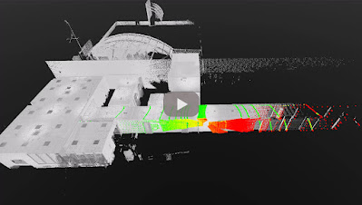
CHANGE DETECTION MAPS

HERON - Change Detection Map


1. Use a point cloud or BIM model as a reference map.
2. Let HERON self-locate with respect to the reference.
3. Produce a survey aligned with the reference map.
4. Detect changes that occurred in the time.
5. Automatically get the change detection map for further editing.

CLOUD SHARING

Mobile mapping is dramatically speeding up the process of capturing 3D and image data. This should be matched by the speed of project delivery and online procedures.


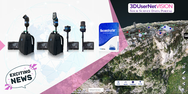
To increase Site to Sight of data efficiency, GEXCEL customers can now link up with 3DUserNet to get a special free annual subscription to the VISION platform with a direct workflow from Reconstructor to 3DUserNetVISION. This will enable users to deliver more efficiently for their customers – with the opportunity to upgrade to a full subscription at a substantial discount at any time.

For additional information: sales@gexcel.it


11 Jan 2023

thumbnail

CHANGELOG - Reconstructor 4.4


Reconstructor 4.4 is out now!

The full changelog is the following:


Added
  • added the "Project data purge" command to remove unused data inside the project folder.
  • added option to remove only groups or groups and contained items when deleting groups from the project view
  • added the option to create UCS from two points and a fixed vertical in the UCS creator window.
  • when exporting models in native formats, added the option to export them in current UCS coordinates. 
  • added the command compute 3D reflectance color layer in the Cloud coloring toolbox and Photo & Color contextual menu. 
  • added a button for computing the histogram in the Inspection dialogue. 
  • added importing annotations from a CSV file with the fields: annotation name; X,Y,Z; comment; hyperlink.
  • added functions to remove big triangles and trim mesh borders in the mesh editor.
  • added support for different rotation ordering conventions in the Euler angles dialogue.
  • added a generic export command for 3DUserNetVISION to export either point clouds (LAS format) or meshes (OBJ format).
  • [HERON add-on] added a tool in the HERON Survey Editor to convert the currently selected frame of a streaming camera to a standalone single-shot camera
  • [HERON add-on] added hide-back facing points option to 3D panorama exporter. 


Changed
  • restored export E57 data in column-major order, since it is the most commonly used memory layout.
  • changed the way in which spherical and cylindrical cameras are drawn in 3D scenes, making the consistent with orthographic and perspective cameras.
  • changed the "UCS coordinates" option behaviour in the adjust pose window so that applying a rotation to the selected item will rotate it around UCS centre coordinates.
  •  improved the responsiveness of the Quick Profile and Tunnel Survey tools when loading existing surveys associated with several models.
  • upgraded the LAS exporter using the latest format version 1.4.
  •  improved the appearance of the point list import dialogue, making it more obvious that the preview is limited to five lines.
  • improved the layout of the camera calibration dialogue to better adapt to screens of different sizes.
  • updated 3D mesh algorithm: mesh generation is now faster and does not require the writing of temporary data to disk.
  • updated Chinese language translation.
  •  improved the Point List Row Format dialogue supporting also the simplest case of text files containing the fields: x,y,z.
  •  improved update 3D scene and the point cloud color list when computing a new color layer from the color map commands.
  • moved "Color with Ambient light", "Add color layer from image" and "Merge and split color layer" commands from the Color Mapping dialogue to the Cloud Coloring toolbox and Photo & Color contextual menu.
  • improved the project item drag and drop functionality, providing better visual feedback on whether an item can be dropped into a particular group within the project.
  • reduced approximation error when computing volume from the plane of a mesh delimited with a polyline.
  •  [HERON add-on] overhauled the Prepare reference map tool with improved user experience and new functionalities to automatically annotate trajectory points when generating from a HERON point cloud.
  • [HERON add-on] reduced the minimum voxel size when importing HERON data to 1mm.
  •  [HERON add-on] updated instruction texts to 3DUserNetVISION and OrbitGT exporters.
  •  [HERON add-on] exported the current rendered point cloud's color layer in HERON third-party exporters.
  •  [HERON add-on] split statistical outliers (SOR), outliers and hide black points steps from sensor noise attenuation filter, in HERON data enhancements import.


Fixed
  • fixed application crash when importing IFC files.
  • fixed the update issue that was rendering geometric shapes with wrong parameters.
  • fixed the cross-sections' computation with geo-referenced data.
  • fixed a failure to import data from another Reconstructor project containing HERON surveys
  • fixed the number of returns detection for LAS data.
  • fixed the fine registration PDF reports not opened.
  • fixed export invalid and noisy coordinates in LAZ export.
  • fixed export truncated coordinates value to textual formats.
  • fixed a bug that prevents computing the area of the mesh.
  • fixed a crash while changing the number of bins in the inspection recipe window. 
  • fixed crash when reading corrupted data from disk.
  • fixed 2D view was not hiding deleted points.
  • fixed crash when importing PTG files with no color data.
  • fixed broken texture mapping functionality.
  • fixed occasional crashes and glitches when loading two models side by side in manual registration.
  • fixed an unintended reset button click by hitting the Enter key in Color Mapping dialogue.
  • fixed the Color Mapping dialogue's excessive size when the min and max labels have many number digits.
  • fixed crash in Color Mapping dialogue computing the histogram using less than three bins.
  • fixed crash while computing the color layer's minimum and maximum values.
  • fixed computation of minimum and maximum values skipping the not-a-number values.
  • fixed a crash due to an invalid histogram in Color Mapping dialogue.
  • fixed a crash caused by a division by zero when painting the histogram in Color Mapping and Inspection dialogues.
  • fixed the Quick Profile tool showing a checkmark even if no profile plane was selected in some rare cases.
  • fixed a bug in the out-of-range field of the PDF report of the inspection.
  • fixed compatibility with systems that use a non-English locale or that have a customized decimal or thousands separator in the Windows regional settings.
  • fixed some issues when using non-metric units of measurement.
  • fixed the formatting of several warning messages that had lost their yellow background.
  • fixed a crash with AMD Radeon GPUs when EDL is enabled in the light settings.
  • [HERON add-on] fixed a failure to import data from another Reconstructor project containing HERON surveys.
  • [HERON add-on] fixed number of returns detection for LAS data.
  • [HERON add-on] fixed the rendering of the Recompute Origin preview from the Send to HERON Desktop tool when the cloud's orientation doesn't match the UCS.
  • [HERON add-on] fixed the rendering of HERON Surveys and their blueprint layers.
  • [HERON add-on] fixed a crash when using certain commands with a heterogeneous multi-selection of items.
  • [HERON add-on] fixed a crash when models with targets are children of another model.
  • [HERON add-on] fixed a crash when creating a reference map from a cloud that doesn't contain a Reflectance layer.
  • [HERON add-on] fixed a crash when importing HERON data from a project where some resources were deleted.
  • [HERON add-on] fixed an issue that made the sub-items of a HERON Survey draggable out of it, resulting in a corrupted project.
  • [HERON add-on] fixed a crash when using point classification functions in projects created through HERON Desktop.
  • [HERON add-on] fixed the formatting of several warning messages that had lost their yellow background.
  • [HERON add-on] fixed an error when computing the spherical coordinates of the HERON 3D panoramas in E57 format.
  • [HERON add-on] fixed a bug that prevents the export of 3D Panoramas when selecting single-shot and streaming cameras.
  • [HERON add-on] fixed a crash if the HERON project file doesn't contain the required metadata for trajectory items.

Removed

  • removed E57 format selection prompt: cloud structure is now automatically detected.
  • removed 3bc auxiliary data from point clouds. Color mapping is now computed on the fly using GPU.


24 Nov 2021

thumbnail

PRESS RELEASE — GEXCEL and 3DUserNetVISION combine to offer speed and efficiency in mobile mapping

HERON & Reconstructor data sharing by 3DUserNetVISION

Brescia, Italy, November 24th, 2021

«We are glad to announce the collaboration with 3DUserNetVISION because this means we can provide our HERON and Reconstructor clients with 3D point clouds and image data sharing services for mapping projects». Giorgia Rossi, International Sales Manager of Gexcel

All data acquired with HERON and all 3D models managed with Reconstructor can now be directly uploaded to 3DUserNetVISION and shared in the cloud. And thanks to this partnership, all existing and new Gexcel customers can get the platform at a special rate.

Getting data quickly from scanner to user is more and more crucial in today's demanding world of survey, where several partners need to easily access 3D models to speed up decision-making processes. Heron and Reconstructor give you high-quality outputs quickly and accurately, VISION makes them worldwide and immediately accessible.

Uploading point clouds, meshes and images directly to 3DUserNetVISION from Reconstructor, gives immediate and secure access to project data for a team, for viewing and collaboration on deliverables. And it works on all your devices, so you have your data with you at all times.

Gexcel customers are able to obtain a 25% discount on their first full year subscription of any VISION modules and data packs. REQUIRE YOUR DISCOUNT >> CLICK HERE

6 Oct 2020

thumbnail

EVENT — The Gexcel program for INTERGEO DIGITAL 2020


Gexcel is ready for the new DIGITAL INTERGEO adventure, and you?

Don't miss the opportunities to better know the Gexcel's products during these days. Join one of our live webinars:

new HERON MS Twin Live demo
Discover the innovative and outstanding Gexcel portable mobile mapping system

OPMMS Open Pit Mine Monitoring System
The powerful system to monitor mines' sites automatically and remotely

RECONSTRUCTOR Point Cloud processing software
Laser scanner+Drone+Thermo camera: a restoration project in Peru

10 Mar 2020

thumbnail

PRESS RELEASE — Gexcel announces RECONSTRUCTOR® 4.2

Brescia, Italy, February 27th, 2020_Gexcel is glad to announce the new release of Reconstructor® that introduces some very interesting improvements for mining, tunnelling, construction, and infrastructure applications thanks to new strategic workflows designed to easily guide customers to final deliverables from the surveying data.


Reconstructor® 4.2 makes a step forward into the processing of large datasets from various 3D sensors and in particular from Mobile Mapping Systems. Reconstructor® 4.2 increases the capability to manage data from tunnels, underground and open-pit mines 3D surveys, thanks to new and improved tools that help users get the result done by a smart process.

Following, a selection of some new key functions introduced in Reconstructor® 4.2:
  • Tunnels, underground and open-pit mines: easy extraction of sequential cross-sections along tunnels axis; measurement of areas and volumes along tunnels; creation of DEM (digital elevation models) starting from 3D point clouds; straight workflow to extract isolines and contours from open-pit mine models and DEMs.
  • Terrain models, buildings and infrastructures: orthophotos can now be used to quickly and efficiently create facades' depth maps. This function can be used also by final clients thanks to the new GoBlueprint free tool. Also, the procedure to extract, display, measure, and move to CAD profiles and cross-sections is now faster and more efficient.
  • Vegetation: colour mapping for point clouds classification and to support the vegetation removal process.
For additional information and demo, click here