Search This Blog

Showing posts with label data integration. Show all posts

24 Nov 2021

thumbnail

PRESS RELEASE — GEXCEL and 3DUserNetVISION combine to offer speed and efficiency in mobile mapping

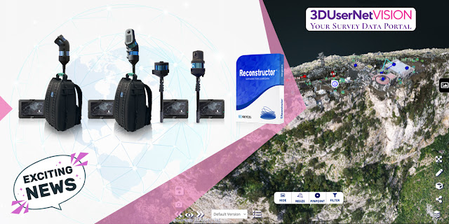
HERON & Reconstructor data sharing by 3DUserNetVISION

Brescia, Italy, November 24th, 2021

«We are glad to announce the collaboration with 3DUserNetVISION because this means we can provide our HERON and Reconstructor clients with 3D point clouds and image data sharing services for mapping projects». Giorgia Rossi, International Sales Manager of Gexcel

All data acquired with HERON and all 3D models managed with Reconstructor can now be directly uploaded to 3DUserNetVISION and shared in the cloud. And thanks to this partnership, all existing and new Gexcel customers can get the platform at a special rate.

Getting data quickly from scanner to user is more and more crucial in today's demanding world of survey, where several partners need to easily access 3D models to speed up decision-making processes. Heron and Reconstructor give you high-quality outputs quickly and accurately, VISION makes them worldwide and immediately accessible.

Uploading point clouds, meshes and images directly to 3DUserNetVISION from Reconstructor, gives immediate and secure access to project data for a team, for viewing and collaboration on deliverables. And it works on all your devices, so you have your data with you at all times.

Gexcel customers are able to obtain a 25% discount on their first full year subscription of any VISION modules and data packs. REQUIRE YOUR DISCOUNT >> CLICK HERE

13 Sept 2018

thumbnail

HERON SUCCESS CASE — STREET EVALUATION AND UNDERGROUND DETECTION


MAPPING AND ANALYSIS OF UNDERGROUND TUNNEL AND UPPER STREETS Aposa underground river, Bologna (Italy)

PDF versione italiana

PROJECT DESCRIPTION

KEYWORDS:  Street evaluation | Urban analysis | Mapping | HERON | Wearable 3D Laser Scanner | Underground city verification


Gexcel, in collaboration with Topcon Italy, College of Surveyors di Bologna and Amici Delle Acque Association, carried out the 3D survey of the underground river Aposa. The ancient tunnels have been mapped and analyzed to verify the level of structural deterioration, dangerous for overlying squares and roads, and to plan possible conservation activities.


HERON outdoor survey of the Aposa river
Fig.1_HERON outdoor survey of the Aposa underground river
Bologna underground tunnel entry
Fig.2_The exit from the city underground tunnel


NEEDS AND GOALS

  • Generate a 3D model of the underground city tunnels
  • Update the existing city map with 3D laser scanner information
  • Obtain a geo-referenced 3D survey
  • Analyze the geometry to prevent collapses or faults and historical monuments deterioration


HERON survey of the Bologna underground tunnel
Fig.3_The Aposa underground tunnels and the HERON surveying 


HERON AC-1 technology has been used to detect approximately one kilometre of route distributed between streets, squares and underground tunnels, without the need for GPS systems. The duration of the survey corresponded to the time taken by the operator to walk. Some spherical targets were placed along the tunnel, noting down their coordinates directly on the HERON Control Unit. In this way, geo-localization could also be achieved. The many cavities along the tunnel were not a problem and the operator was able to survey even the narrowest of them.  (See Video)


Bologna underground topographic surveying
Fig.4_Topographic surveying of a portion of the Aposa tunnels


The topographic survey was carried out, using 8 control stations and 40 reference points for a high geometric accuracy result. The Topcon GLS2000 static laser scanner survey was necessary for a very old and particularly damaged part of the tunnel. In this way, high-resolution data was obtained, useful for an accurate analysis of the actual state of the structure.


Bologna 3D underground analysis
Fig.5_Bologna underground tunnel and upper street analysis 

Aposa underground tunnel cross section
Fig.6_The Aposa Underground tunnel cross-section


Combining the HERON global survey with high-resolution scans, it was possible to document a significant urban area, obtaining multilevel information and a complete 2D and 3D mapping.
Here some of the HERON technology benefits:

  • Fast mapping of a large area in difficult surveying conditions
  • Fast and frequent update of site’s 3D models' thanks to the automatic geo-localization feature. Operators with basic knowledge in surveying and geo-localization can easily manage it. 
  • Easy integration with coloured point clouds from terrestrial laser scanners


RESULTS

  • Detailed technical table
  • Plans, sections, elevations, high-resolution orthophotos and photo plans
  • 3D point cloud model
  • 3D model flythrough movies
  • Topcon terrestrial laser scanner and HERON mobile mapping system joint 3D model


Aposa: Bologna underground 3D model
Fig.7_The joint 3D model visualized in the JRC 3D Reconstructor software


26 Jul 2018

thumbnail

DOCUMENTATION OF CRIME SCENES AT BRESCIA UNIVERSITY (Italy)

Multiresolution and muti-sensors integration for Forensic studies and documentation.

KEYWORDS: Forensic | University | DPI-8X | HERON AC-1 | FARO Focus3D

    Forensic project at Brescia University


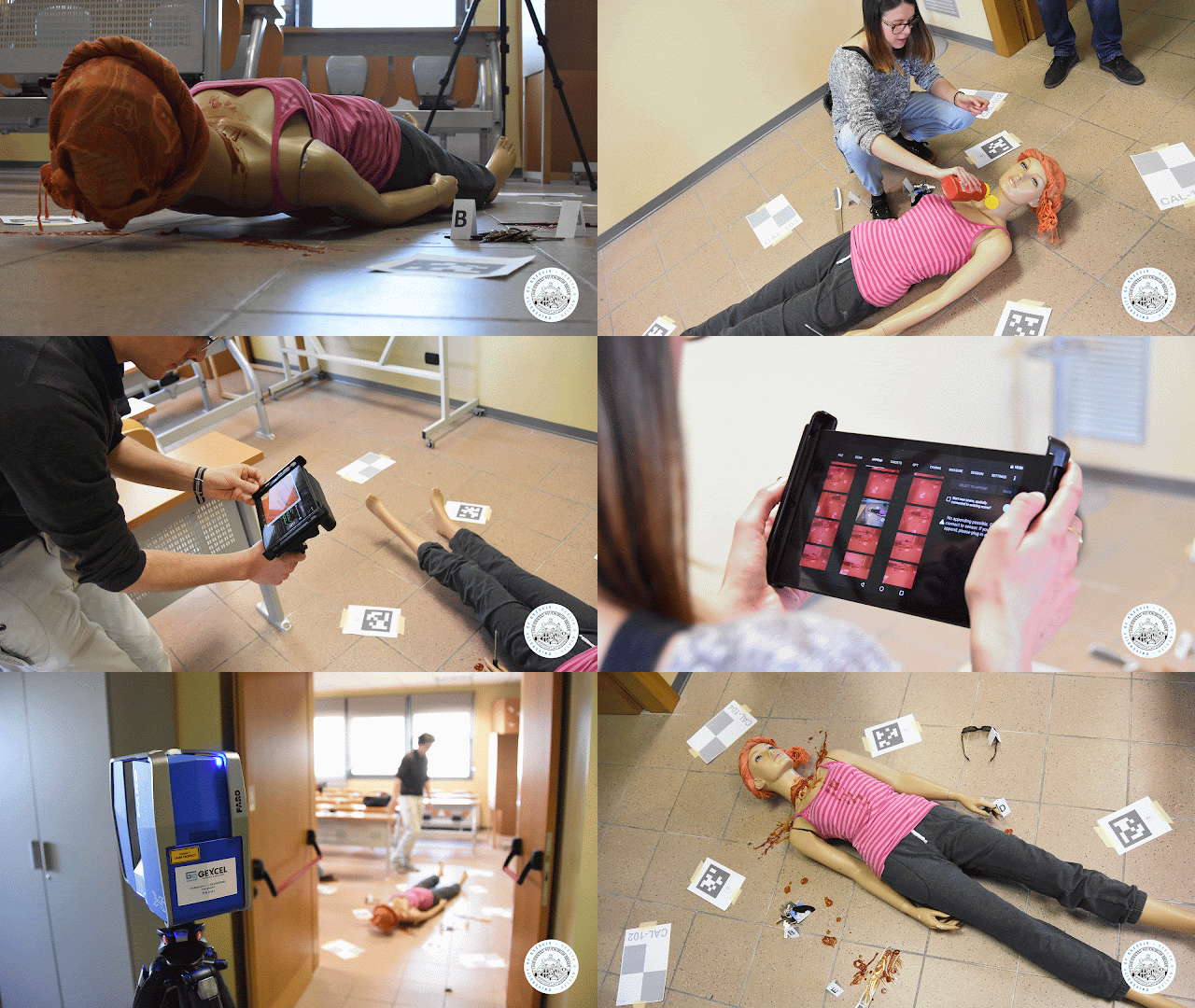
    This was the topic of the annual "student project" asked the students attending the International English speaking course of Advanced Geomatics at the University of Brescia (Italy). Students were asked to create a virtual crime scene and proceed to the 3D documentation of the virtual site. Everything was carried out in full autonomy and only with the external supervision of the course teachers (prof. Vassena and assistant Chiamone). Several technologies, most of them provided by Gexcel, have been applied. The full crime scene has been acquired by iMM HERON, the local (room) site Faro Focus3D and the virtual body scanned by Dot Product DPI-8X handheld scanner.


    Download NOW the full project and enjoy! 
    ( 5,4 Gbyte and the FREE Rec viewer ) 

    We thank all the students of the course for their creativity, their interest in the field work and the quality of the realized project. Well done!


      ABOUT

      ADVANCED GEOMATICS  | unibs-advanced-geomatics
      Advanced Geomatics is a University of Brescia Master's Degree course on Civil and Environmental Engineering. The Advanced Geomatics course introduces Master's students to 3D surveying, mapping and documentation technologies. The students, thanks to intense lab activities, can use and apply 3d surveying technologies and instruments. In particular, students learn how to use and how to carry on the data elaboration of static laser scanners, handheld scanners, Indoor and outdoor mapping solutions. Students learn also how to carry on rigorous surveying applications using digital photogrammetry.

      6 Feb 2018

      thumbnail

      PRESS RELEASE — GEXCEL and 3DFLOW: a stronger partnership to integrate LiDAR and Photogrammetric technologies

      6th February, 2018, Italy — Gexcel is proud to announce the latest strengthening of the partnership with 3DFlow, finalized to improve the integration between their specific sectors: LiDAR and Photogrammetry.


      The task to provide to the market outstanding solutions and products capable to integrate LiDAR and Digital Photogrammetry is one of the main strategic goal of both companies, Gexcel and 3DFlow.

      The partnership between Gexcel and 3DFlow started in 2012, when an innovative software for digital Photogrammetry was commonly customized and named PixR3 to satisfy the needs of Gexcel's customers.

      In these years the competence and the diffusion of Gexcel's products in the global LiDAR market are dramatically grown and the products like JRC 3D Reconstructor® (software for LiDAR data management) and HERON® (SLAM based mapping wearable system) are became estimated and well known products worldwide.

      On the other hand, also the worldwide presence and high competence of 3DFlow products and services in the digital photogrammetric field are exponentially grown. For this reason both partners have commonly decided to be more focused on their main technology competence, not forgetting the strategic importance of the integration between LiDAR and Digital Photogrammetry products.
         
      The strengthen partnership will allow Gexcel to full benefit of the 3DFlow technology in a more integrated and cross way. Gexcel portfolio will be now enriched with all the 3DF Zephyr® software solutions, perfectly integrated with JRC 3D Reconstructor® LiDAR software, to provide ever more complete solutions to users and final clients.


      Follow Gexcel on gexcel.it/software/3df-zephyr to learn more on the software integration and 3DF Zephyr® software.


      About Gexcel

      Gexcel has a rich history spanning more than 10 years of proven fully featured LiDAR and imagery analysis software like the well-known JRC 3D Reconstructor®. Gexcel’s software are compatible with the LiDAR sensors of the main laser scanner manufactures such as Faro, Geomax, Riegl, Stonex, Surestar, Teledyne-Optech, Topcon, Trimble, Velodyne and Z+F. Gexcel is currently present on the market with innovative surveying systems (HERON® and OPMMS®) and it is involved, with several partners, in various projects for the development of innovative solutions based on laser scanner, SLAM and digital photogrammetry. Gexcel was established in 2007 from the academic know-how of the University of Brescia and the applied research achievements of the European Joint Research Centre (JRC), located in Ispra (Italy).

      About 3DFlow
      3Dflow is a completely private held consulting company and software house operating in the field of Computer Vision and Image Processing. It was established in 2011 as a spin-off of the University of Verona and in 2012 it became a spin-off of the University of Udine. 3Dflow is a dynamic, innovative company committed to providing cutting-edge solutions and software components involving Photogrammetry, 3D modeling of reality, 3D processing and 3D visual effects. Its customers ranges from small local industries to worldwide leading entertainment companies.

      --------------


      Published on:

      - https://www.geoconnexion.com/news/a-partnership-to-integrate-lidar-and-photogrammetric-technologies
      - http://www.amerisurv.com/content/view/16560/
      - http://www.lidarmag.com/content/view/12650/

      11 Sept 2017

      thumbnail

      CASE STUDY — Fast 3D mapping and "as built - as designed" analysis of a Le Corbusier style building in Italy


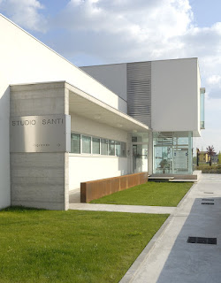
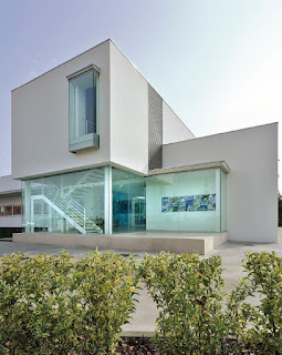
      A pleasant Le Corbusier style building has been surveyed with HERON to analyze the structure realization and study how its shape could be inserted in the urban context.


      Location Studio Santi Castel Goffredo, ItalyLocation Studio Santi Castel Goffredo, Italy

      • Location: Studio di Architettura e Ingegneria "Arnaldo Santi" of Castel Goffredo (North Italy)
      • Application: by Topotek Srl
      • Industry: Construction
      • Surveying system: HERON AC-1 Color


      HERON has been able to impressively respond to the two main specific customer's needs:
      1. Check the correspondences between the existing BIM project (as designed) and the geometric results of the as-built construction process.
      2. Carry on fast surveying of large areas, getting results almost in real-time in order to quickly pass to a pre-projects analysis and operate in construction sites affected by fast changes.


      IN DETAIL...

      The entire survey of the indoor/outdoor parts of the site took about 10 minutes.

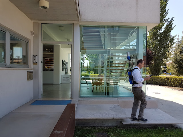
      HERON survey of Studio Santi building
      The surveying process at Studio Santi site by using HERON AC-1 mobile surveying system

      After only 20 minutes of elaboration, a scaled plan view of the site was available and ready to be visualized in a CAD environment. The point cloud, obtained from HERON, has been moved into JRC 3D Reconstructor software where the BIM model of the building has been compared with the HERON point cloud model.


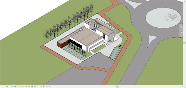
      Revit model of Studio Santi building
      The Autodesk Revit model of the building realized with a BIM approach

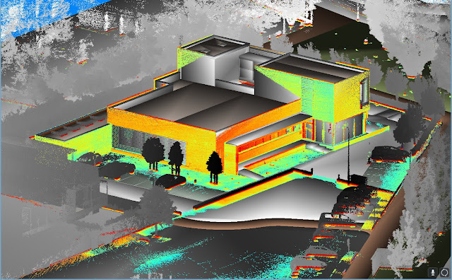
      HERON and BIM models comparison in JRC 3D Reconstructor
      The comparison between BIM model and Heron data in JRC 3D Reconstructor

      The results show the good correspondence (2-3 cm of differences measured) between the BIM model and the reality. The experience has shown the high productivity and accuracy (tested with few control points) of the HERON SLAM approach thanks to a high resolution 32 lines Velodyne rotating laser scanner and a robust patented "global optimization" approach.

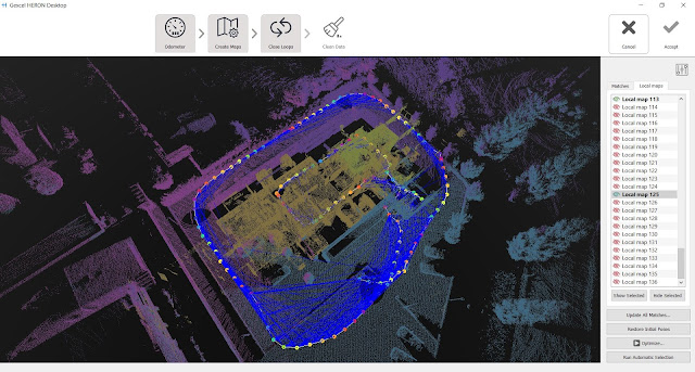
      HERON Global Optimization
      The result of the global optimization process

      In order to insert the 3D survey of the building within a new survey of the city centre, the HERON automatic self-localization function has been used. The HERON post processed point cloud model of the building was loaded inside HERON that used it as reference model. Coming back to the site some days after the first acquisition, HERON was able to automatically recognize its position respect to the point cloud reference model and start mapping the city center. In this way, the 3D fast mapping model of the town has been easily joined to the 3D model of the building, without using targets or reference points.

      heron blue print of studio santi mantova italy
      Fast blueprint image of the 3D mapping of Castel Goffredo town

      The town survey required 3 hours, at a normal walking speed, without care of sky visibility and without requiring a local calibration. Stairs, trees, different geometries are not a problem for HERON and the 3D survey data are directly visible, in real-time, on the touch screen control unit provided with the instrument. The first result of the HERON survey is the so-called "fast blueprint image": an easy result that can be immediately imported into CAD software without any other 3D point cloud data processing.

      heron blue print of studio santi mantova italy
      Fast blueprint images of the 3D mapping of Castel Goffredo town, including the Studio Santi site


      WHAT THE BENEFITS OF HERON TECHNOLOGY?
      • HERON can strongly support the construction sites in fast "as-built / as designed" analysis, where a 2-3 cm accuracy can be acceptable.
      • The automatic geo-localization capability can introduce the innovative fast and frequent 3D models updating services, carried on by operators with basic knowledge in surveying and geolocalization.

      Thanks to Studio di Architettura e Ingegneria "Arnaldo Santi" and Topotek Srl

      13 Apr 2017

      thumbnail

      EVENT — HERON and Focus3D integration at the FARO 3D Conference 2017

      April, 2017, Brescia (Italy) — Are you a FARO user and are you interested in learning more about the smart integration between your Focus3D scans and Gexcel HERON® 3D models?


      Come to the FARO 3D Conference on April, 27th-28th (Germany): Gexcel will present this great innovation by showing a dedicated presentation focused on a real case where this technology has been used to speed up the surveying activities and furnish a complete final project. 

      >> Register now <<  Come to the Conference and discover all the latest state of the art in reality capture, to exchange in technical meetings through real user examples and to discuss with experts.

      Don't miss the Gexcel Presentation, on Thu, 27th at 9.45 amto see how easily HERON® can make your Focus3D laser scanner surveys more competitive and efficient in a very simple way! Access the complete Conference Agenda.


      For more information and appointments
      please contact:

      Giorgia Rossi arch.
      International Sales Manager | Gexcel Srl
      E. sales@gexcel.it
      P. +39 030 65 95 001


      Subscribe the Gexcel's newsletter and follow us on our channels:
      [ youtube ]  [ twitter ]  [ facebook ]  [ linkedin ]


      About Gexcel
      Gexcel Srl has a rich history spanning more than 10 years of proven fully featured lidar and imagery analysis software packages as JRC 3D Reconstructor®, PointR3 and PixR3. Well-suited to all terrestrial, mobile and airborne scanners, Gexcel solutions are compatible and provided from all the main laser scanner manufacturers as DotProduct, Faro, Teledyne-Optech, Riegl, Stonex, Topcon, Trimble and Z+F. Gexcel Srl was established in 2007 from the academic know-how of the University of Brescia and the applied research achievements of the European Commission Joint Research Centre (JRC), located in Ispra (Italy).