Search This Blog

Showing posts with label construction. Show all posts

3 Jun 2019

thumbnail

PRESS RELEASE — HERON®-Verity Integration Introduces Real-Time 3D Mobile Mapping and Construction Verification


HERON - Verity integration


The collaboration between HERON, the latest wearable mobile scanners from Gexcel and Verity construction verification software from ClearEdge3D, significantly advances scan-to-BIM workflows with streamlined data collection and construction QA/QC

Manassas, VA – May 29, 2019 – ClearEdge3D, makers of EdgeWise, Verity, and Rithm for Navisworks software, is pleased to announce a collaboration with Gexcel, makers of HERON® wearable scanners, that was unveiled at the SPAR 3D & AEC NEXT conferences last week in Anaheim, CA. 
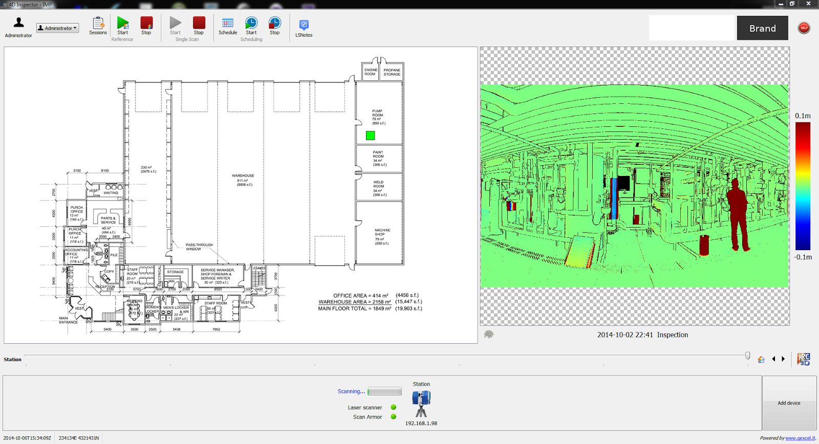
The two companies have joined forces to make it even quicker and easier for AEC professionals to conveniently gather as-built data with Gexcel’s HERON wearable laser scanners—and to compare that data against design/fabrication models using ClearEdge3D’s Verity software, allowing 100% verification of installed work in real-time.
"The partnership between ClearEdge3D and Gexcel brings together two globally recognized AEC tech leaders in the 3D world that are committed to making scan-to-BIM workflows more efficient with truly cutting-edge technologies," - Matteo Sgrenzaroli, Gexcel R&D Manager 
“It’s not just a commercial agreement, but a demonstration of our commitment to providing outstanding solutions to our customers and the AEC industry." - Giorgio Vassena, Gexcel CEO
“The HERON scanner is a state-of-the-art 3D mobile scanner powered with cutting edge Simultaneous, Localization And Mapping (SLAM) technology. It features a host of proprietary algorithms to minimize drift and maximize accuracy and speed. We are excited to add it to our growing hardware portfolio.” - Kelly Cone, VP of AEC Industry Strategy at ClearEdge3D. 
This forward-thinking partnership makes it even easier and more convenient for users to find construction mistakes before they become expensive problems. Using real-time visualization of survey results, users can promptly identify out-of-tolerance or inaccurately constructed work. For companies interested in learning more about this collaboration, please contact us at: sales@gexcel.it for more information. 


About ClearEdge3D 
ClearEdge3D is a global technology leader in the Architectural/Engineering/Construction (AEC) industry, offering advanced software solutions that help firms model existing conditions and verify that recently completed work has been constructed correctly. The company’s EdgeWise software dramatically speeds labor-intensive 3D modeling workflows by utilizing advanced automated feature extraction and assistive modeling technology. Its Verity construction verification software compares point cloud data of recently completed work against a design or fabrication model, flagging any out-of-tolerance or poorly installed elements. For more information, please visit http://www.clearedge3d.com. 

About Gexcel 
Gexcel started in 2007 with the mission to turn the latest scientific achievements in the field of geomatics into hi-tech products and services for wide areas of application. Gexcel is a worldwide well-known company capable to transform its know-how in advanced 3D surveying technologies, innovative and productive software and instruments. Gexcel has a rich history spanning more than 10 years of proven fully featured LiDAR and imagery analysis software compatible with all the lidar sensors of the main laser scanner manufacturers. Gexcel is currently present on the market with innovative surveying instruments and it is involved, with several partners, in various projects for the development of innovative solutions based on laser scanner, SLAM and digital photogrammetry.   

26 Jun 2018

thumbnail

HERON SUCCESS CASE — ENERGY REQUALIFICATION

FROM LASER SCANNER SURVEY TO 3D BIM MODEL Chigi Palace, Rome (IT)

PDF versione italiana

PROJECT DESCRIPTION

KEYWORDS: Engineering | Heritage | BIM | Heron | 3D Mapping 

The Chigi Palace is a historic building, in the heart of Rome, currently the seat of the Government of the Italian Republic. The entire building was taken over for the purpose of constructing a 3D BIM model aimed at energy redevelopment, therefore without the need for millimetric accuracy.

HERON outside the Chigi Palace

« The survey with HERON was very useful for the creation of the BIM model. Simply walking through the rooms of the historic building, we quickly got an enormous amount of data, subsequently used by the customer for CAD modeling.»

Giorgio Dotti
Gexcel | Surveyor

NEEDS AND GOALS
  • 3D survey of the historic building for energy efficiency
  • Speed and confidentiality during the course of the survey
  • Creation of a BIM model

The quick execution of the survey campaign was made possible thanks to the integration of several relevant methodologies, in particular, thanks to the real-time mobile acquisition made with HERON.


HERON during the Chigi courtyard survey and HERON point cloud 3D model integration
Fig.2_HERON during the Chigi courtyard survey | Fig 3. HERON point cloud 3D model integration

HERON AC-1 MAIN BENEFITS

  • Efficiency: saving time and money 
  • Effectiveness of the functions
  • Accuracy of the final results
  • Management of different data types (mobile and static scanners)

    Zoller+Fröhlich laser Scanner 51010C "Sala dei mappamondi" static scan acquisition
    Fig.4_Zoller+Fröhlich laser Scanner 51010C "Sala dei mappamondi" static scan acquisition

    The survey phase with HERON took place in the internal and external regions of the building, for a duration of 3 days and a total of about 25.000 m², divided into 94 dynamic acquisitions with a resolution of about 2 cm. At the same time, 54 detailed scans (with an average resolution of 4 mm) were captured with Z+F static laser scanner, then georeferenced by classical topography.

      HERON point cloud inserted into Chigi Palace BIM model
      Fig.5_HERON point cloud inserted into Chigi Palace BIM model

      Starting from the point clouds, we worked with special modelling software to obtain the 3D reconstruction of the building.

      RESULTS
      • Georeferenced point cloud 
      • 3D Model
      • BIM modelling of the entire building

      TECHNICAL DETAILS
      • SURVEYING SYSTEM: HERON AC-1 - Zoller+Fröhlich 5010C
      • SURVEYED AREA: 2.500 sqm
      • SURVEYING TIME: 3 days, 25.000 m²
      • PROCESSING SOFTWARE: HERON Desktop - JRC 3D Reconstructor - ArchiCAD
      • DATA PROCESSING TIME: 1 month for the final result


      ABOUT

      CSG Palladio | www.csgpalladio.org
      Polytechnic laboratory for companies and professionals requiring clear answers in the field of materials technology, structures, civil construction, industrial research and cultural heritage. The Client requested to Gexcel the rental with the operator of the HERON equipment for the data acquisition activities. The data processing and the final delivery were performed by the Client.


      11 Sept 2017

      thumbnail

      CASE STUDY — Fast 3D mapping and "as built - as designed" analysis of a Le Corbusier style building in Italy


      A pleasant Le Corbusier style building has been surveyed with HERON to analyze the structure realization and study how its shape could be inserted in the urban context.


      Location Studio Santi Castel Goffredo, ItalyLocation Studio Santi Castel Goffredo, Italy

      • Location: Studio di Architettura e Ingegneria "Arnaldo Santi" of Castel Goffredo (North Italy)
      • Application: by Topotek Srl
      • Industry: Construction
      • Surveying system: HERON AC-1 Color


      HERON has been able to impressively respond to the two main specific customer's needs:
      1. Check the correspondences between the existing BIM project (as designed) and the geometric results of the as-built construction process.
      2. Carry on fast surveying of large areas, getting results almost in real-time in order to quickly pass to a pre-projects analysis and operate in construction sites affected by fast changes.


      IN DETAIL...

      The entire survey of the indoor/outdoor parts of the site took about 10 minutes.

      HERON survey of Studio Santi building
      The surveying process at Studio Santi site by using HERON AC-1 mobile surveying system

      After only 20 minutes of elaboration, a scaled plan view of the site was available and ready to be visualized in a CAD environment. The point cloud, obtained from HERON, has been moved into JRC 3D Reconstructor software where the BIM model of the building has been compared with the HERON point cloud model.


      Revit model of Studio Santi building
      The Autodesk Revit model of the building realized with a BIM approach

      HERON and BIM models comparison in JRC 3D Reconstructor
      The comparison between BIM model and Heron data in JRC 3D Reconstructor

      The results show the good correspondence (2-3 cm of differences measured) between the BIM model and the reality. The experience has shown the high productivity and accuracy (tested with few control points) of the HERON SLAM approach thanks to a high resolution 32 lines Velodyne rotating laser scanner and a robust patented "global optimization" approach.

      HERON Global Optimization
      The result of the global optimization process

      In order to insert the 3D survey of the building within a new survey of the city centre, the HERON automatic self-localization function has been used. The HERON post processed point cloud model of the building was loaded inside HERON that used it as reference model. Coming back to the site some days after the first acquisition, HERON was able to automatically recognize its position respect to the point cloud reference model and start mapping the city center. In this way, the 3D fast mapping model of the town has been easily joined to the 3D model of the building, without using targets or reference points.

      heron blue print of studio santi mantova italy
      Fast blueprint image of the 3D mapping of Castel Goffredo town

      The town survey required 3 hours, at a normal walking speed, without care of sky visibility and without requiring a local calibration. Stairs, trees, different geometries are not a problem for HERON and the 3D survey data are directly visible, in real-time, on the touch screen control unit provided with the instrument. The first result of the HERON survey is the so-called "fast blueprint image": an easy result that can be immediately imported into CAD software without any other 3D point cloud data processing.

      heron blue print of studio santi mantova italy
      Fast blueprint images of the 3D mapping of Castel Goffredo town, including the Studio Santi site


      WHAT THE BENEFITS OF HERON TECHNOLOGY?
      • HERON can strongly support the construction sites in fast "as-built / as designed" analysis, where a 2-3 cm accuracy can be acceptable.
      • The automatic geo-localization capability can introduce the innovative fast and frequent 3D models updating services, carried on by operators with basic knowledge in surveying and geolocalization.

      Thanks to Studio di Architettura e Ingegneria "Arnaldo Santi" and Topotek Srl

      12 Jan 2015

      thumbnail

      WEBINAR on JRC 3D Reconstructor CONSTRUCTION & MINING - FARO Edition

      Gexcel is very glad to invite you at the Webinars focused on the JRC 3D Reconstructor CONSTRUCTION & MINING packages for FARO users, translated in 3 languages.

      Learn how to leverage on 3D laser scanning for your surveying tasks to reduce operation time and increase productivity in the construction and mining industries!

      South East Asia and India
      Date: 4 Feb 2015, Wed
      Time: 1pm (SG time / GMT 8.00)

      China
      Date: 5 Feb 2015, Thu
      Time: 2pm – 4.30pm (CN time)

      Japan
      Date: 12 Feb 2015, Thu
      Time: 2pm – 3pm (JP time)

      If you are interested in partecipating to one of this Webinar, please make a registration through the following links: SEA  |  INDIAN  |  CHINISE  |  JAPANISE

      For any further information, please contact our sales department: sales@gexcel.it

      9 Oct 2014

      thumbnail

      PRESS RELEASE — New Gexcel 4D INSPECTOR® for automatic 3D measurement and inspection of buildings and infrastructures

      9th October, 2014, Berlin, INTERGEO — At INTERGEO, Gexcel has announced the new 4D INSPECTOR®: the perfect solution to automatically monitor possible deformations and get results in real time.


        What for?  

      • For automatic 3D inspection of buildings, tunnels, industrial plants, complex structures, etc.
      • For surveying and monitoring large construction sites, big infrastructures, also when frequent 3D surveys are needed
        How?  
      1. Several static laser scanners, located in different positions, can be fully controlled by a remote control unit
      2. The operator can schedule a scanning agenda and 4D INSPECTOR® automatically drives the scanners located in the surveying site
      3. The data are downloaded, directly via Ethernet, to the 4D INSPECTOR® control unit
      4. In real time, the 4D INSPECTOR® evaluates and visualizes the deformations obtained from a comparison between the scans and the reference model
        More:  
      • The scanners can be mounted inside a safety enclosure (Scan Armor®) and protected by direct damages
      • All the point clouds used to check the deformation are stored in the control unit and can be used for detailed data analysis
      • 4D INSPECTOR® actually works with Faro and Z+F static laser scanner

      4D INSPECTOR® was created in the Gexcel's research laboratories located in the Polaris Technology Park of Sardegna Ricerche (Pula, Sardinia – Italy).


      4d-inspector-gexcel
      4D INSPECTOR®: Project Creation


      4d-inspector-gexcel
      4D INSPECTOR®: Real Time Results


      14 Jun 2013

      thumbnail

      PRESS RELEASE — Gexcel selected as partner in monitoring construction of tallest skyscraper in Milan

      6th of June, 2013, Brescia, Italy_Gexcel and its advanced laser scanner technologies have been chosen by Colombo Costruzioni to carry on the "as built" analysis and monitoring of the Milan Isozaki Tower, the tallest Italian skyscraper in Milan, built for the EXPO 2015 event. 
      Gexcel will provide engineering monitoring services and software tools based on the gexcel R3 advanced analysis and Cloud Streaming gexcel R3Xtream software platforms.
      An extremely user friendly tool capable of managing huge 3D point clouds dataset, easily extracts plants, façade and profiles, the overall construction of the tower will be monitored employing the gexcel R3 software. Up to now, the gexcel R3 functionalities were accessible only inside JRC 3D Reconstructor. With this newest release, gexcel R3 works as a standalone software without the need for a JRC 3D Reconstructor licence. Visualization and data sharing is implemented through direct internet browser support.
      The  gexcel R3 software further expands Gexcel's line of advanced analysis and visualization products, JRC 3D Reconstructor and Cloud Streaming software gexcel R3Xtream. These new software solutions can use lidar data acquired with almost any type of laser scanning and imaging devices, whether it is airborne, mobile or tripod mounted.

      *  *  *

      Gexcel e le sue avanzate tecnologie laser scanner sono stati scelti da Colombo Costruzioni per gestire l'analisi "as built" e il monitoraggio della Torre Isozaki di Milano, il più alto grattacielo italiano costruito a Milano per l'EXPO 2015. Gexcel fornirà i servizi di monitoraggio ingegneristico e strumenti software basati sulle piattaforme software di analisi avanzate gexcel R3 Cloud Streaming gexcel R3Xtream.
      Grazie all'estrema semplicità di utilizzo, alla capacità di gestire enormi dataset di nuvole di punti 3D e di estrarre facilmente piante, facciate e profili, l'intera costruzione della torre sarà monitorata utilizzando il software gexcel R3. Fino ad ora, le funzioni di gexcel R3 erano accessibili sono all'interno dei software JRC 3D Reconstructor. Con la nuova release, gexcel R3 lavora in modalità stand alone senza bisogno di alcuna licenza JRC 3D Reconstructor. la visualizzazione e la condivisione dei dati è implementata attraverso il supporto diretto di browser Internet.
      gexcel R3 amplia ulteriormente la linea di Gexcel delle analisi avanzate e dei prodotti di visualizzazione, JRC 3D Reconstructor e Cloud Streaming software gexcel R3Xtream. Queste nuove soluzioni software possono utilizzano dati lidar acquisiti con quasi ogni tipo di dispositivo laser scanner e di imaging, sia aereo, mobile o terrestre.

      24 Apr 2013

      thumbnail

      Gexcel at the FARO 3D Documentation Conference in Singapore


      Gexcel will be represented at the FARO 3D Documentation Conference Asia Pacific in Singapore 25th and 26th of April by its Product Sales & Technical Manager Arch. Giorgia Rossi. Thursday 25 at 3 pm, Gexcel will present the software solutions for Construction field adopted by constructions companies for the tall structures "as built" analysis. Please, feel free to arrange a meeting with Gexcel representatives by sending an email to sales@gexcel.it

      watch a preview of the software solution
      Gexcel tall structures: vertical skyscraper analysis


      *   *   *   *

      Gexcel sarà presente alla FARO 3D Documentation Conference Asia Pacific di Singapore il 25 e 26 Aprile tramite il proprio Product Sales & Technical Manager Arch. Giorgia Rossi. Giovedì 25 alle ore 15, le soluzioni per l'ambito delle costruzioni, adottate da settore Engineering & Consulting per la supervisione delle attività di certificazione "as built" presso i nuovi grattacieli in fase di realizzazione a Milano ed in particolare i cantieri della Torre Isozaki (Area City Life), del Bosco Verticale (Milano Porta Nuova) e del Grattacielo Unicredit (Milano Porta Nuova). Per concordare un incontro durante l'evento, scrivere a sales@gexcel.it