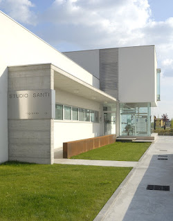
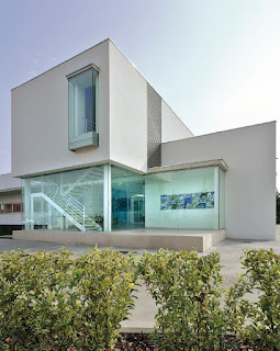
A pleasant Le Corbusier style building has been surveyed with HERON to analyze the structure realization and study how its shape could be inserted in the urban context.
- Location: Studio di Architettura e Ingegneria "Arnaldo Santi" of Castel Goffredo (North Italy)
- Application: by Topotek Srl
- Industry: Construction
- Surveying system: HERON AC-1 Color
HERON has been able to impressively respond to the two main specific customer's needs:
- Check the correspondences between the existing BIM project (as designed) and the geometric results of the as-built construction process.
- Carry on fast surveying of large areas, getting results almost in real-time in order to quickly pass to a pre-projects analysis and operate in construction sites affected by fast changes.
IN DETAIL...
The entire survey of the indoor/outdoor parts of the site took about 10 minutes.
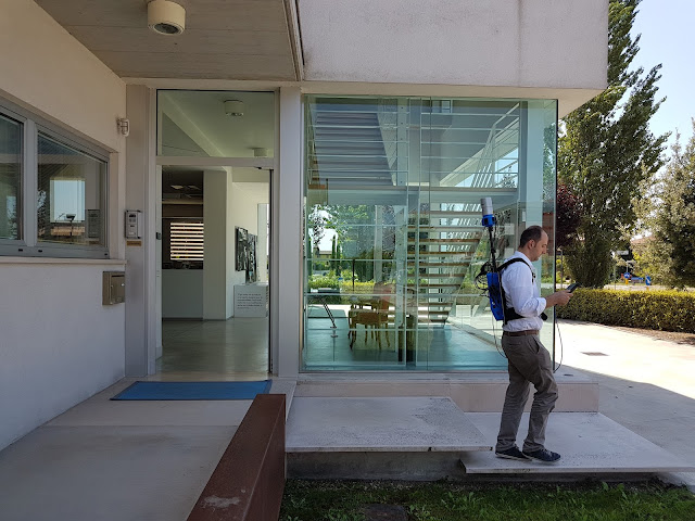 |
| The surveying process at Studio Santi site by using HERON AC-1 mobile surveying system |
After only 20 minutes of elaboration, a scaled plan view of the site was available and ready to be visualized in a CAD environment. The point cloud, obtained from HERON, has been moved into JRC 3D Reconstructor software where the BIM model of the building has been compared with the HERON point cloud model.
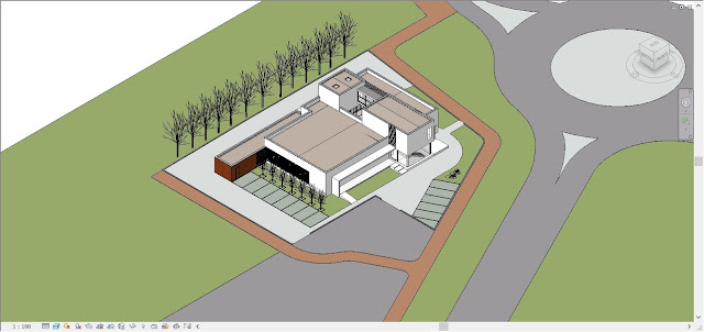 |
| The Autodesk Revit model of the building realized with a BIM approach |
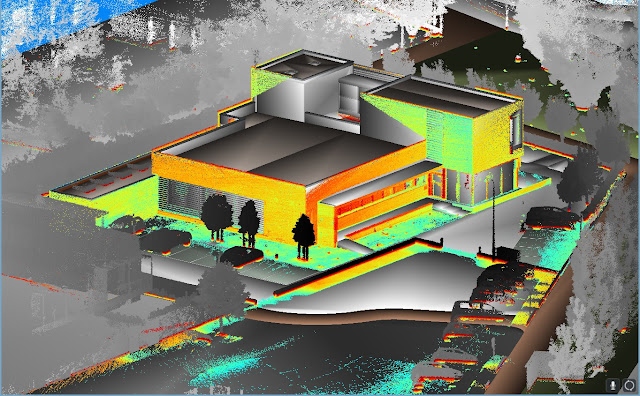 |
| The comparison between BIM model and Heron data in JRC 3D Reconstructor |
The results show the good correspondence (2-3 cm of differences measured) between the BIM model and the reality. The experience has shown the high productivity and accuracy (tested with few control points) of the HERON SLAM approach thanks to a high resolution 32 lines Velodyne rotating laser scanner and a robust patented "global optimization" approach.
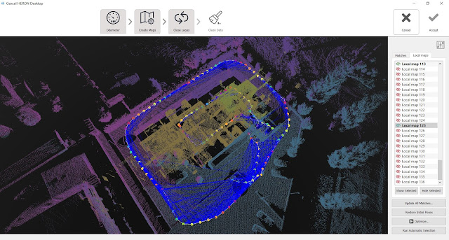 |
| The result of the global optimization process |
In order to insert the 3D survey of the building within a new survey of the city centre, the HERON automatic self-localization function has been used. The HERON post processed point cloud model of the building was loaded inside HERON that used it as reference model. Coming back to the site some days after the first acquisition, HERON was able to automatically recognize its position respect to the point cloud reference model and start mapping the city center. In this way, the 3D fast mapping model of the town has been easily joined to the 3D model of the building, without using targets or reference points.
 |
| Fast blueprint image of the 3D mapping of Castel Goffredo town |
The town survey required 3 hours, at a normal walking speed, without care of sky visibility and without requiring a local calibration. Stairs, trees, different geometries are not a problem for HERON and the 3D survey data are directly visible, in real-time, on the touch screen control unit provided with the instrument. The first result of the HERON survey is the so-called "fast blueprint image": an easy result that can be immediately imported into CAD software without any other 3D point cloud data processing.
 |
| Fast blueprint images of the 3D mapping of Castel Goffredo town, including the Studio Santi site |
WHAT THE BENEFITS OF HERON TECHNOLOGY?
- HERON can strongly support the construction sites in fast "as-built / as designed" analysis, where a 2-3 cm accuracy can be acceptable.
- The automatic geo-localization capability can introduce the innovative fast and frequent 3D models updating services, carried on by operators with basic knowledge in surveying and geolocalization.
Thanks to Studio di Architettura e Ingegneria "Arnaldo Santi" and Topotek Srl
11:12:00 am
Tags :
case studies
,
construction
,
data integration
,
gexcel
,
heron
Subscribe by Email
Follow Updates Articles from This Blog via Email


No Comments