Search This Blog

5 Dec 2013

thumbnail

UAV & Spherical images in the new JRC 3D Reconstructor 2.9.1


UAV data handling


Use the color information to extract in detail 
- Volumes
- Isolines
- Cross sections

know more


Spherical image positioning


Increase the quality for
- Point cloud texturizing
- Mesh colouring
- Time saving


know more


... all this and more in the new  JRC 3D Reconstructor 2.9.1 !


How to update your license


Visit the new  Gexcel TUTORIALS web page


12 Nov 2013

thumbnail

PRESS RELEASE — Spherical Images Mapping and 3D Stonex data managing on JRC 3D Reconstructor 2.9.1 at SPAR Europe and ELMF - Booth 213

12nd November, 2013, Brescia, Italy_Gexcel Srl is attending SPAR Europe and ELMF to introduce new 3D software tools and solutions focusing on the most recent release of the worldwide renowned JRC 3D Reconstructor® software for Spherical Images Mapping and 3D Stonex laser scanner data managing. In step with the path of the latest technologies in three dimensional laser scanning and photogrammetry, Gexcel Srl has released the new version of JRC 3D Reconstructor® 2.9.1 with a special and unique feature to map Spherical Images on Point Cloud data. These images, directly generated by the 3D laser scanner or by thirdy party software, can be easily and semi automatically mapped onto the point cloud  producing a 3D HR texturized point cloud and 3D HR texturized mesh models. Gexcel is also proud to announce that the new version of JRC 3D Reconstructor® 2.9.1 will manage the 3D laser scanner data acquired by the newest Stonex X300. Fully developed to guarangtee the Stonex data treatment, JRC 3D Reconstructor® 2.9.1 enables to cover the different industry fields.


Published on:
http://www.amerisurv.com/content/view/11998/
http://www.lidarnews.com/content/view/10125/
http://www.geoconnexion.com/news/gexel-presenting-3d-software-at-spar-and-elmf-2013
http://www10.giscafe.com/nbc/articles/view_article.php?articleid=1234919

3 Oct 2013

thumbnail

PRESS RELEASE — Gexcel will present the new point clouds streaming service at Intergeo 2013 (Hall 3 | Booth F3.033)

3rd of October, 2013, Brescia, Italy_Gexcel  will be launching the new Gexcel Point Cloud Streaming Service at Intergeo 2013. Based on an extremely easy to use web application, the service allows to upload point clouds generated using gexcel R3 or the new gexcel R3 streaming software to a remote server. gexcel R3 can import data directly from the most common point cloud data formats, E57 included.  
Massive point clouds loaded in the service servers can be visualized and navigated in Chrome or Firefox using a standard 64 bit PC.
This revolutionary service, based on an easy to use workflow, will drastically improve the ability of users to visualize the results of 3D laser scanning surveys with collaborators, clients and the web community. The 3D point clouds can also be customized to include proprietary company logos and project banners.

Come and visit us ! Hall 3 | Booth 3.033 at INTERGEO 2013, 8-10 October, Essen, Germany


Published on
http://www.amerisurv.com/content/view/11857/
http://www10.giscafe.com/nbc/articles/1/1224183/new-Gexcel-Point-Clouds-Streaming-Service-Intergeo-2013

25 Sept 2013

thumbnail

PRESS RELEASE — JRC 3D Reconstructor UAV integration at INTERGEO 2013 (Hall 3 | Booth F3.033)

25th September, 2013, Brescia, Italy_Gexcel is attending INTERGEO, the prime international event to introduce new 3D software tools and solutions focusing on the most recent release of the worldwide renowned JRC 3D Reconstructor software for Unmanned Aerial Vehicle (UAV) and Drone platforms.
In step with the path of the latest technologies in three dimensional laser scanning and photogrammetry, Gexcel has released the new version of JRC 3D Reconstructor 2.9.1 with a special and very strong focus on UAV and Drone platforms. UAV and Drones can quickly and cheaply capture georeferenced High Resolution (HR) images. 
Third parties software typically produces GeoTIFF global images and 3D point clouds of the investigated area. These ingredients can be easily managed in JRC 3D Reconstructor to merge the GeoTIFF global image color over the point cloud and produce a 3D HR texturized point cloud and 3D HR texturized mesh models. Using JRC 3D Reconstructor all the volume calculations, cross sections, cut & fill, crests & toes, isolines, etc., can be created with a greater accuracy, thanks to the real color state processing. This new feature again emphasizes the importance that JRC 3D Reconstructor gives to the color information. It is considered as a most powerful tool for detailed geotechnical and geological investigations.

Come and visit us ! Hall 3 | Booth 3.033 at INTERGEO 2013, 8-10 October, Essen, Germany


Published on
http://www.amerisurv.com/content/view/11818/

4 Sept 2013

thumbnail

Easy 3D CAD re-drawing of Solid Images (depth images)


English_Thanks to the new gexcel CAD plug-in, import Solid Images (depth images) in CAD and directly re-draw
  • 3D polylines
  • profiles
  • sections
  • perimeters
Download your 3 days DEMO VERSION !  With the Solid Images data you can test the plug-in immediatly !

*   *   *   *

Italiano_Grazie al nuovo gexcel CAD plug-in, importa Solid Images in CAD e ridisegna direttamente
  • polilinee 3D
  • profili
  • sezioni
  • perimetri
Scarica la VERSIONE DEMO (3 giorni) ! Con dati di Solid Images per testare immediatamente il plug-in !

29 Aug 2013

thumbnail

Microgeo S.A. magazine about JRC 3D Reconstructor

English_Thanks to the strong and powerful collaboration between Gexcel and its partner Microgeo SA, now is available online the JRC 3D Reconstructor magazine for the Chilean market. High level of technology and specifical knowledge of both hardware, software and solutions helped Microgeo SA to build a strong market of Gexcel's products concerning Heritage and Construction fields of application but especially for Mining-Tunnelling activities. Microgeo SA keeps working on updating and generating new markets for laser scanning surveying, monitoring and 3D modelling and we are very proud of our partnership.


*  *  *  *

Italiano_Grazie alla stretta collaborazione tra Gexcel e il suo partner Microgeo SA, è ora disponibile il Magazine online di JRC 3D Reconstructor per il mercato cileno. L'elevato livello tecnologico e le specifiche conoscenze di hardware, software e soluzioni, hanno aiutato Microgeo SA a costruire un forte mercato dei prodotti Gexcel, legati all'ambito dei beni culturali e delle costruzioni, ma specialmente all'ambito delle attività estrattive. Microgeo SA continua a lavorare sull'aggiornamento e la ricerca di nuovi mercati per il rilevamento laser scanner, il monitoraggio e la modellazione 3D e Gexcel è davvero orgogliosa di questa partnership.

17 Jul 2013

thumbnail

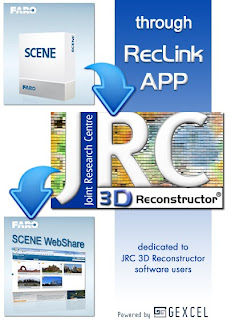
RecLinkAPP: the perfect connection between JRC 3D Reconstructor and FARO

English_JRC 3D Reconstructor software is now perfectly integrated with software and hardware FARO platforms, thanks to the new RecLinkAPP for Scene 5.1: the starting point for a productive workflow that goes from Scene to JRC 3D Reconstructor packages and than back to Scene WebShare! Go to the FARO App Center and FREE download RecLinkAPP!


*  *  *  *


Italiano_I software JRC 3D Reconstructor e le piattaforme hardware e software di FARO sono ora perfettamente integrati, grazie alla nuova RecLinkAPP per Scene 5.1il punto di partenza per processi produttivi che vanno da Scene ai software JRC 3D Reconstructor e nuovamente in Scene WebShare! Accedi all'App Center di FARO e scarica GRATUITAMENTE RecLinkAPP!

9 Jul 2013

thumbnail

Gexcel at the first Innovation Fair - SINNOVA 2013 (Sardinia, Italy)

English_Gexcel is attending the first SINNOVA Conference with a presetation concerning the new OPMMS System for monitoring of landslides, volumes, subsidences, mines that allows clever scans and images data storage, mining inspection, alarm out of range report E-Mail. The event will take place in Cagliari (Sardinia, Italy) on July, 12th and 13rdFor more information, click here.


* * * *

Italiano_Gexcel parteciperà al 1° Salone dell'Innovazione (SINNOVA 2013) e interverrà con una presentazione sul nuovo Sistema OPMMS per il monitoraggio di frane, volumi, avvallamenti, cave che consente un'archiviazione intelligente di immagini e scansioni, inspection delle estrazioni, report via E-mail di allarmi fuori campo. L'evento si terrà a Cagliari il 12 e 13 Luglio. Per maggiori informazioni, cliccare qui.

5 Jul 2013

thumbnail

Gexcel's Collaboration with Microgeo S.A. Chile for new software solutions in monitoring and data processing


English_Microgeo S.A. consolidated in the development of solutions for the monitoring and processing of laser scanner data. The activity took place during days 6 and June 7, 2013. This time we had the pleasure of participating in training with our important strategic partner: Gexcel company with its important data processing solutions for laser scanning as JRC 3D Reconstructor, gexcel R3 and the last solution OPMMS  (Open Pit Mining Monitoring Solution) developed with the support of Geodesy Area of Microgeo S.A. Gexcel company born and maintains a strong partnership with the European Research Centre (JRC) based in the town of Ispra, Italy. We are proud to have the knowledge, research and development offered by this important strategic partner.


Italiano_Microgeo S.A. consolidata nello sviluppo di soluzioni per il monitoraggio ed elaborazione dei dati laser scanner. L'attività si è svolta nei giorni 6 e 7 giugno 2013. Questa volta abbiamo avuto il piacere di partecipare alla formazione con il nostro importante partner strategico, la società Gexcel con le sue soluzioni di elaborazione dati le scansione laser come JRC 3D Reconstructor, gexcel R3 ed ultima nata la soluzione OPMMS (Open Pit Mining Monitoring System) sviluppata per il monitoraggio delle cave con il supporto dell'area di Geodesia di Microgeo S.A. L'azienda Gexcel nasce e mantiene una forte partnership con il Centro dio Ricerca Europeo (JRC) con sede nel comune di Ispra, Italia. Siamo orgogliosi di avere la conoscenza, la ricerca e lo sviluppo offerti da questo importante partner strategico.

1 Jul 2013

thumbnail

PRESS RELEASE — Gexcel presents its software solution for the Faro Asia Pacific 3D TLS Challenges in Heritage Documentation Webinars

1st of July, 2013, Brescia, Italy_Gexcel will be joining with Faro Asia Pacific in presenting its software solution for the 3D Heritage Documentation. Technical Manager Architect Giorgia Rossi will present the dedicated workflow to manage 3D Faro data in the Cultural Heritage field in two webinars on 10th of July at 1.00 pm and 11th of July at 2.00 pm, both Singapore time (UCT/GMT +8).


The use of laser scanning in the heritage field is already a well accepted procedure to help the digital preservation of cultural sites all over the world. The FARO 3D terrestrial laser scanners and Gexcel software solutions provide cultural heritage experts with the newest unique methods to extract the information needed. These webinar sessions will demonstrate easy and intuitive workflows, where anyone involved in the heritage sector can create scaled orthoimages, elevations, plans and sections, to assist with the set up and execution of the restoration project.

The following links will direct you to the specific webinars suited for your language and regional needs:

For additional information contact Gexcel: www.gexcel.it - sales@gexcel.it
See the previous post of this appointment

28 Jun 2013

thumbnail

A teaching experience from the University of Brescia (Italy), using JRC 3D Reconstructor

I would like to share with you some nice results obtained by my students at the engineering course of Advanced Geomatics (University of Brescia, Italy) using Faro laser scanner + JRC 3D Reconstructor, created and produced entirely by themselves. If you want to send them your comments, please connect to the Facebook Project web page

Watch the video of Laser Scanner Experience LEE UNIBS

(posted by Giorgio Vassena)
* * *

Vorrei condividere con voi alcuni risultati ottenuti dai miei studenti al corso di ingegneria di Geomatica Avanzata (Università di Brescia) utilizzando Faro laser scanner + JRC 3D Reconstructor, creati e realizzati interamente da loro. Se volete inviare loro i vostri commenti, collegatevi alla pagina Facebook del progetto.

(post di Giorgio Vassena)

14 Jun 2013

thumbnail

PRESS RELEASE — Gexcel selected as partner in monitoring construction of tallest skyscraper in Milan

6th of June, 2013, Brescia, Italy_Gexcel and its advanced laser scanner technologies have been chosen by Colombo Costruzioni to carry on the "as built" analysis and monitoring of the Milan Isozaki Tower, the tallest Italian skyscraper in Milan, built for the EXPO 2015 event. 
Gexcel will provide engineering monitoring services and software tools based on the gexcel R3 advanced analysis and Cloud Streaming gexcel R3Xtream software platforms.
An extremely user friendly tool capable of managing huge 3D point clouds dataset, easily extracts plants, façade and profiles, the overall construction of the tower will be monitored employing the gexcel R3 software. Up to now, the gexcel R3 functionalities were accessible only inside JRC 3D Reconstructor. With this newest release, gexcel R3 works as a standalone software without the need for a JRC 3D Reconstructor licence. Visualization and data sharing is implemented through direct internet browser support.
The  gexcel R3 software further expands Gexcel's line of advanced analysis and visualization products, JRC 3D Reconstructor and Cloud Streaming software gexcel R3Xtream. These new software solutions can use lidar data acquired with almost any type of laser scanning and imaging devices, whether it is airborne, mobile or tripod mounted.

*  *  *

Gexcel e le sue avanzate tecnologie laser scanner sono stati scelti da Colombo Costruzioni per gestire l'analisi "as built" e il monitoraggio della Torre Isozaki di Milano, il più alto grattacielo italiano costruito a Milano per l'EXPO 2015. Gexcel fornirà i servizi di monitoraggio ingegneristico e strumenti software basati sulle piattaforme software di analisi avanzate gexcel R3 Cloud Streaming gexcel R3Xtream.
Grazie all'estrema semplicità di utilizzo, alla capacità di gestire enormi dataset di nuvole di punti 3D e di estrarre facilmente piante, facciate e profili, l'intera costruzione della torre sarà monitorata utilizzando il software gexcel R3. Fino ad ora, le funzioni di gexcel R3 erano accessibili sono all'interno dei software JRC 3D Reconstructor. Con la nuova release, gexcel R3 lavora in modalità stand alone senza bisogno di alcuna licenza JRC 3D Reconstructor. la visualizzazione e la condivisione dei dati è implementata attraverso il supporto diretto di browser Internet.
gexcel R3 amplia ulteriormente la linea di Gexcel delle analisi avanzate e dei prodotti di visualizzazione, JRC 3D Reconstructor e Cloud Streaming software gexcel R3Xtream. Queste nuove soluzioni software possono utilizzano dati lidar acquisiti con quasi ogni tipo di dispositivo laser scanner e di imaging, sia aereo, mobile o terrestre.

13 Jun 2013

thumbnail

3D Forensic: mobile high-resolution 3D-Scanner and 3D data analysis for forensic evidence


Gexcel is one of the partners of the 3D Forensic research program, founded by the European Commission (Seventh Framework Programme) with the aim to study and develop advanced solutions for the 3D documentation on forensic applications.
The reserach program is under the co-ordination of  Dr. Peter Kuhmstedt from the Fraunhofer Institute for Applied Optics and Precision Engineering IOF in Jena (www.iof.fraunhofer.de). 
The other partners are the Forensische Opsporing Politie Zeeland (The Netherlands), DelfTech BV (The Netherlands), Lucas Instruments Gmbh (Germany), Enclustra GmbH (Switzerland) and Crabbe Consulting Ltd (UK). 


*  *  *

Gexcel è uno dei partners del programma di ricerca 3D Forensic, istituito dalla Commissione Europea (Seventh Framework Programme) con la finalità di studiare e sviluppare soluzioni avanzate per la documentazione 3D nelle applicazioni in ambito forense.
Coordinatore del programma il Dr. Peter Kuhmstedt del Fraunhofer Institute for Applied Optics and Precision Engineering IOF di Jena (www.iof.fraunhofer.de). 
Gli altri partners: Forensische Opsporing Politie Zeeland (Olanda), DelfTech BV (Olanda), Lucas Instruments Gmbh (Germania), Enclustra GmbH (Svizzera) e Crabbe Consulting Ltd (Regno Unito). 

22 May 2013

thumbnail

Webinar: 3D TLS Challenges in Heritage Documentation

10 July, Wed at 1:00 pm* (GMT+8:00) Gexcel, joining with FARO Asia, will organize the free online Webinar "3D TLS Challenges in Heritage Documentation".

Laser scanner is already a consolidated procedure for digital preservation of cultural sites all over the world. Gexcel software solutions and FARO 3D terrestrial laser scanner provide Cultural Heritage experts with the newest and unique method to extract the needed information.

Gexcel will focus on the easy and intuitive workflows - in JRC 3D Reconstructor Heritage-Architectonical and gexcel R3 - to create scaled orthoimages, façades, plants and sections in order to set up restoration projects without worries related to the amount of data to manage.

* For China and Japan, the Webinar will take place on 11 July, Tus at 1:00 pm (GMT +8:00)


*  *  *

Mercoledì 10 Luglio ore 13.00 (GMT+8:00) Gexcel, unendosi a FARO Asia, organizzerà la Webinar "3D TLS Challenges in Heritage Documentation" (partecipazione gratuita). 

L'utilizzo della tecnologia Laser Scanner è già una procedura consolidata per la conservazione dei beni culturali in tutto il mondo. Le soluzioni software Gexcel e i laser scanner FARO forniscono agli esperti di questo settore i metodi più innovativi ed unici per estrarre le informazioni di cui hanno bisogno.

Gexcel mostrerà i facili ed intuitivi workflow - in JRC 3D Reconstructor Heritage-Architectonical e gexcel R3 - per la creazione di ortoimmagini scalate, facciate, piante e sezioni, necessarie per realizzare progetti di conservazione senza preoccupazioni legate alla dimensioni dei dati da trattare.

Maggiori dettagli e registrazione

20 May 2013

thumbnail

The new born gexcel R3 stand alone software

  • To handle 3D unlimited lidar data
  • To manage huge 3D point cloud projects
  • To easily extract plants, elevations, profiles
  • To create 2D Image for CAD 3D redrawing
  • To generate new rendering of points
  • Inside an extremely simple interface


Watch how to make the CAD redrawing easier, faster and funnier!


 *   *   *   *

Il nuovo software gexcel R3 che permette di
  • gestire dati lidar 3D senza limiti
  • gestire grandi progetti 3D 
  • estrarre facilmente piante, facciate, profili
  • creare immagini 2D per il ridisegno 3D in CAD
  • generare nuovi rendering di punti
  • lavorare con un'interfaccia estremamente semplice

24 Apr 2013

thumbnail

Gexcel at the FARO 3D Documentation Conference in Singapore


Gexcel will be represented at the FARO 3D Documentation Conference Asia Pacific in Singapore 25th and 26th of April by its Product Sales & Technical Manager Arch. Giorgia Rossi. Thursday 25 at 3 pm, Gexcel will present the software solutions for Construction field adopted by constructions companies for the tall structures "as built" analysis. Please, feel free to arrange a meeting with Gexcel representatives by sending an email to sales@gexcel.it

watch a preview of the software solution
Gexcel tall structures: vertical skyscraper analysis


*   *   *   *

Gexcel sarà presente alla FARO 3D Documentation Conference Asia Pacific di Singapore il 25 e 26 Aprile tramite il proprio Product Sales & Technical Manager Arch. Giorgia Rossi. Giovedì 25 alle ore 15, le soluzioni per l'ambito delle costruzioni, adottate da settore Engineering & Consulting per la supervisione delle attività di certificazione "as built" presso i nuovi grattacieli in fase di realizzazione a Milano ed in particolare i cantieri della Torre Isozaki (Area City Life), del Bosco Verticale (Milano Porta Nuova) e del Grattacielo Unicredit (Milano Porta Nuova). Per concordare un incontro durante l'evento, scrivere a sales@gexcel.it

2 Apr 2013

thumbnail

Hydrogeological risk: high-resolution LiDAR data sharing


Gexcel signals the article published on Geomedia magazine (write by Giorgio Vassena - Gexcel's president - and his research group at the University of Brescia) concerning the application within the hydrogeological an innovative technology that enables the sharing and viewing of high density data, even in a network.